In collaboration with Uber, I analyzed rideshare activity, traffic counts, and observational data to understand how curb space is used in urban environments. I worked closely with data scientists to interpret findings and identify strategies that improve safety, efficiency, and overall curb productivity.
Design Objective: Translate curb usage data into clear, actionable insights that support safer and more efficient curb management for Uber.
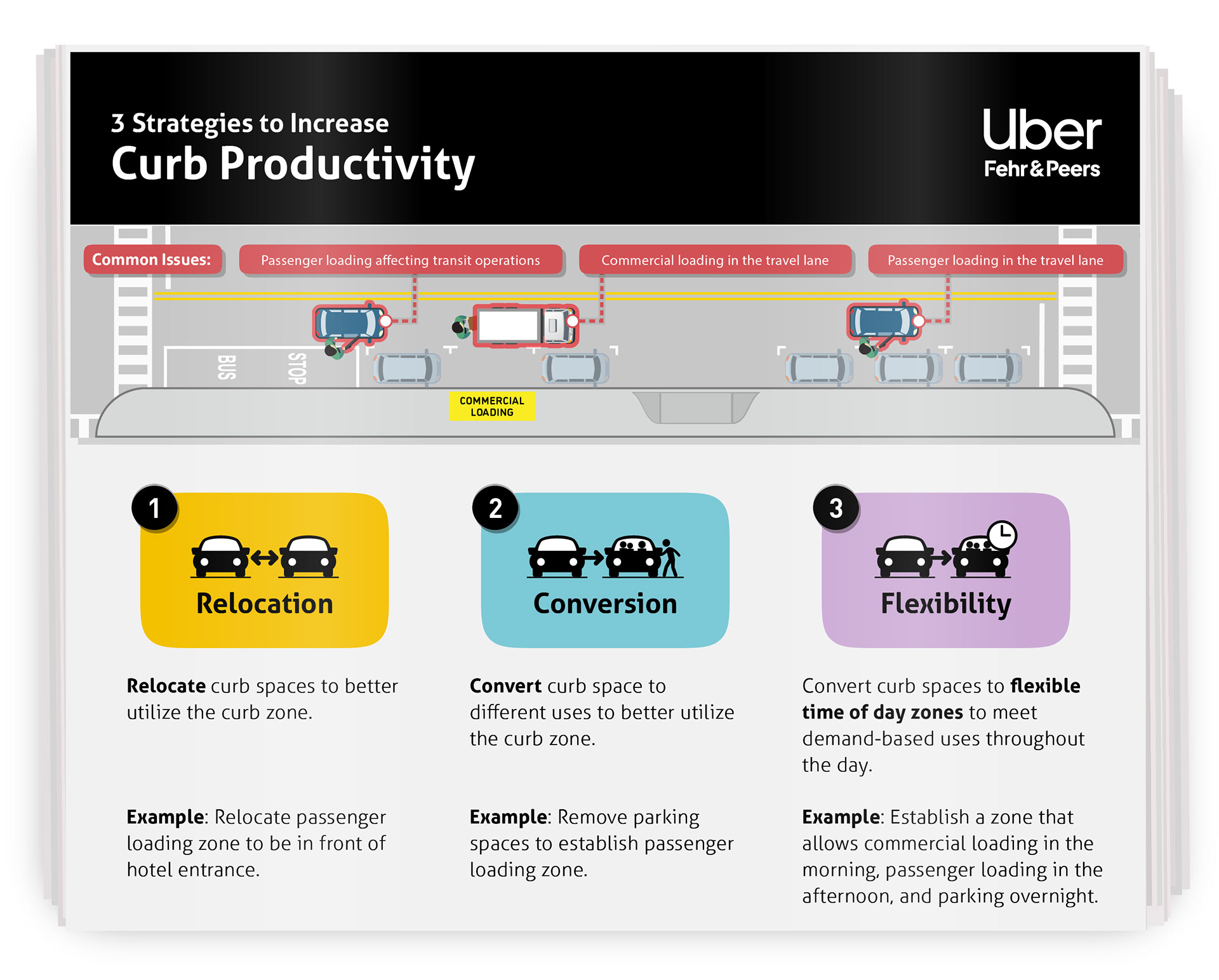
I developed a visual approach to communicate these insights through clear, actionable graphics. Working within Uber’s brand guidelines, I designed a set of visuals that highlight common curb challenges and illustrate strategies such as Relocation, Conversion, and Flexible Use. The final work enables stakeholders to quickly interpret complex data and apply insights to real-world conditions.
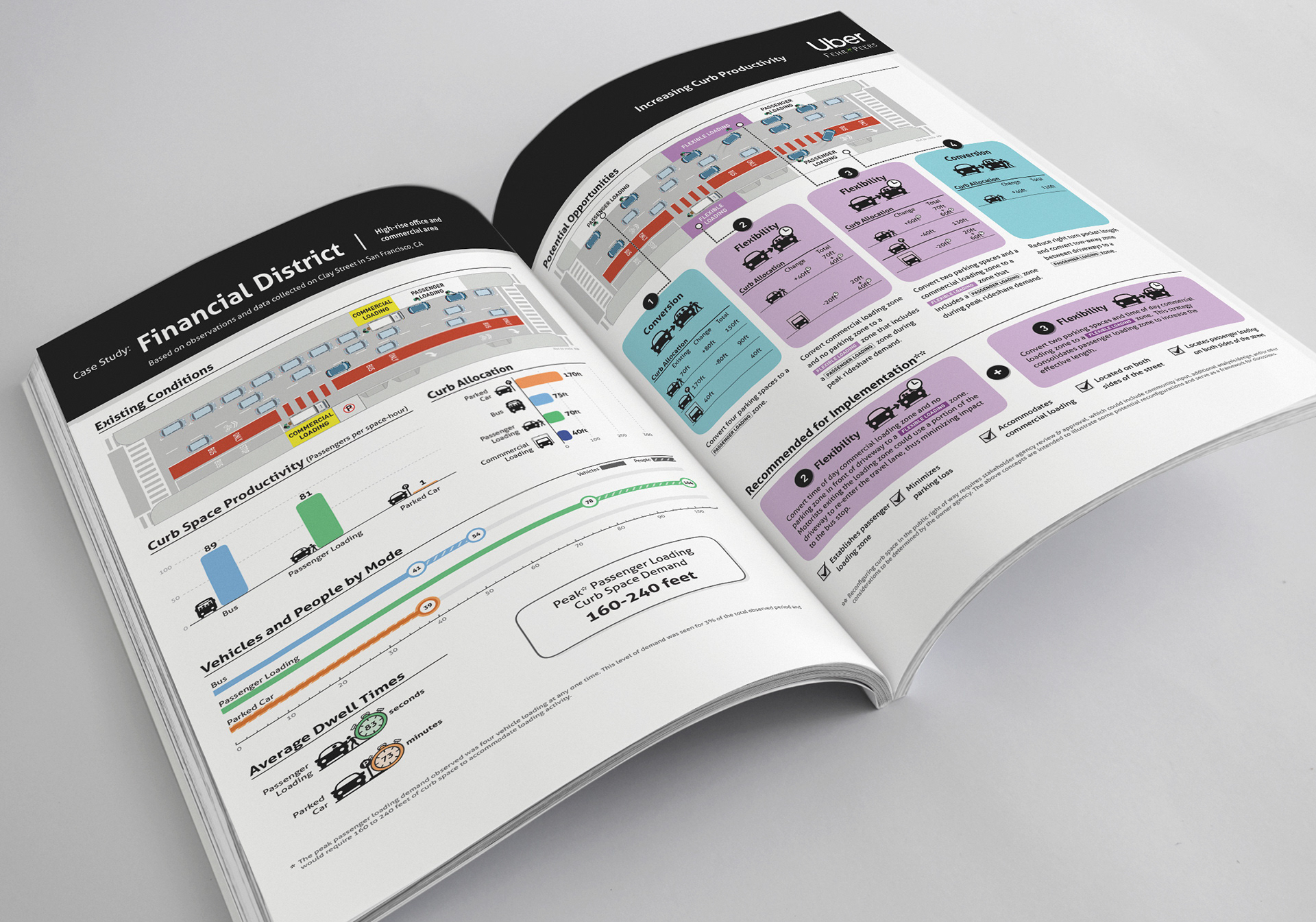
These case studies below show how curb use patterns shift across four street types: Financial District, Commercial Corridor, High Density Office Neighborhood, and Bicycle Corridor. By comparing curb productivity, allocation, dwell time, modal activity, and peak passenger loading demand, the analysis revealed that passenger loading and transit consistently moved more people per foot of curb than parked cars, but each corridor required a different strategy. Some locations needed major reallocation to meet high loading demand, while others could be improved through smaller flexible or time based changes. These boards were designed as decision making tools to help city partners understand tradeoffs and identify ways to make curb space more efficient and better matched to actual use.
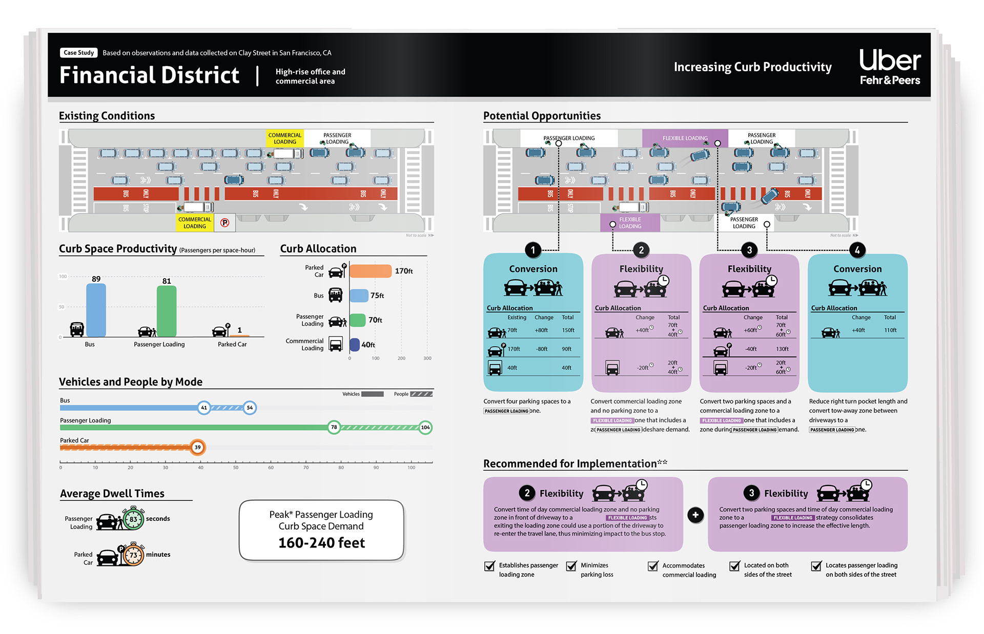
Financial District: High demand, high turnover environment where passenger loading significantly outperforms parking, requiring larger curb reallocations and flexible loading strategies.
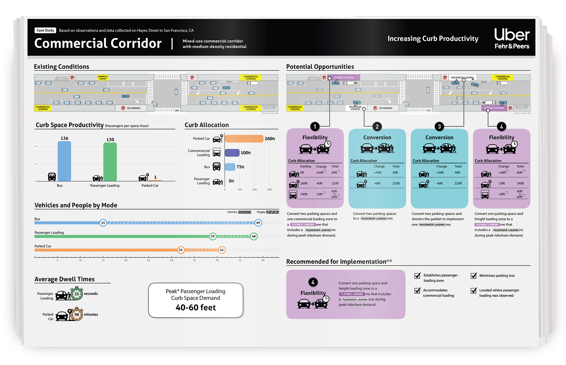
Commercial Corridor: Moderate, mixed demand context where targeted conversions and time based flexibility improve efficiency without major disruption to existing uses.
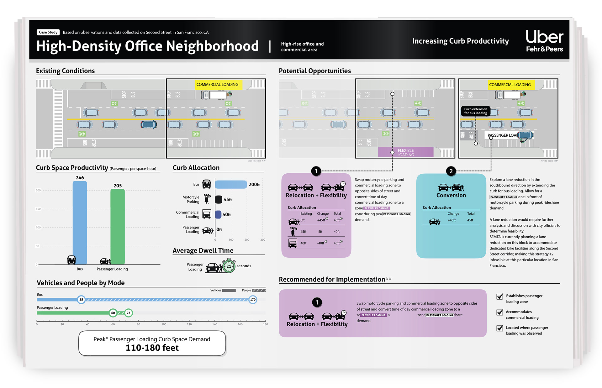
High Density Office Neighborhood: Peak period driven demand with strong transit and passenger loading activity, calling for strategic reallocation and potential street level interventions.
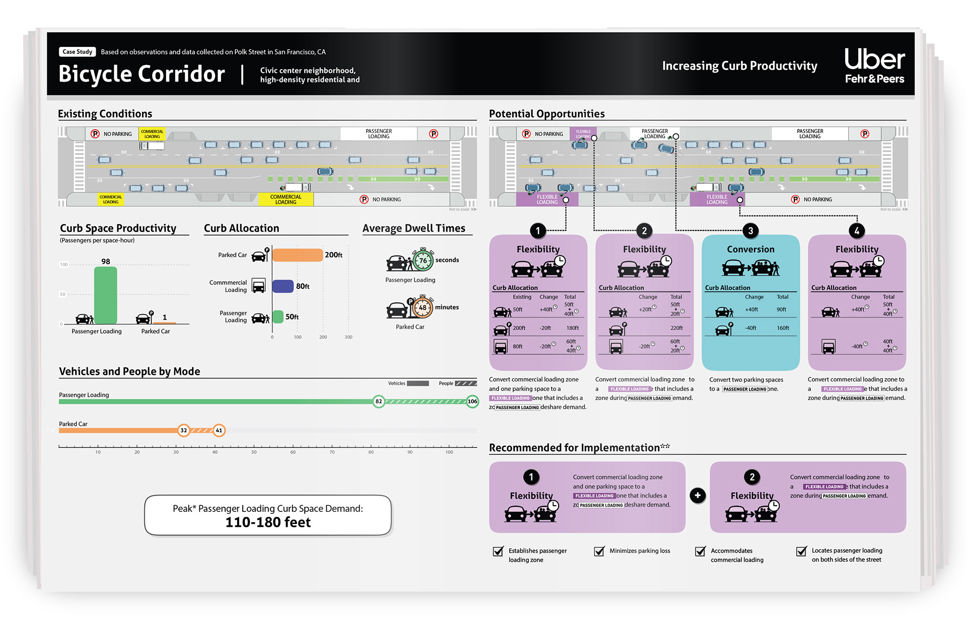
Bicycle Corridor: Balanced multimodal corridor where passenger loading demand must be integrated carefully alongside existing bike infrastructure through flexible curb use.
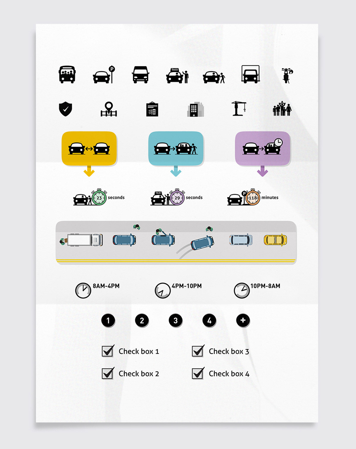
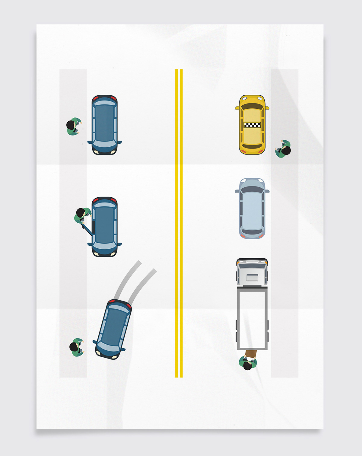
I developed a modular visual language to translate complex curbside operations into clear, scalable communication tools. This system includes a custom icon set, simplified spatial diagrams, and time based interaction patterns that illustrate how different curb uses shift throughout the day. By abstracting real world behaviors into consistent visual elements, these assets enable quick understanding across cross functional teams and support decision making in dynamic, data driven environments.