King County Metro operates more than 8,000 bus stops and transit centers, many of which serve as transfer hubs between multiple routes and modes. These spaces play a critical role in the rider experience, yet they are often inconsistent, difficult to navigate, and not designed as cohesive environments.
Project Objective: Translate the complex planning guidance into a visual tool that decision makers can reference to design safer, more intuitive, and consistent transit hub experiences.
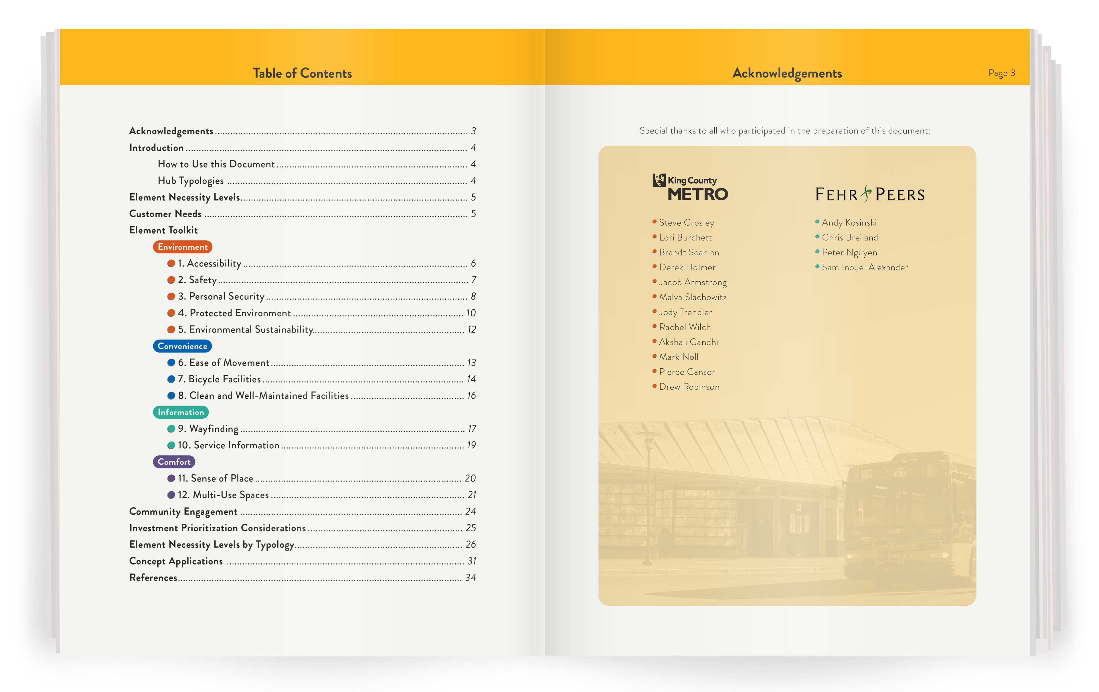
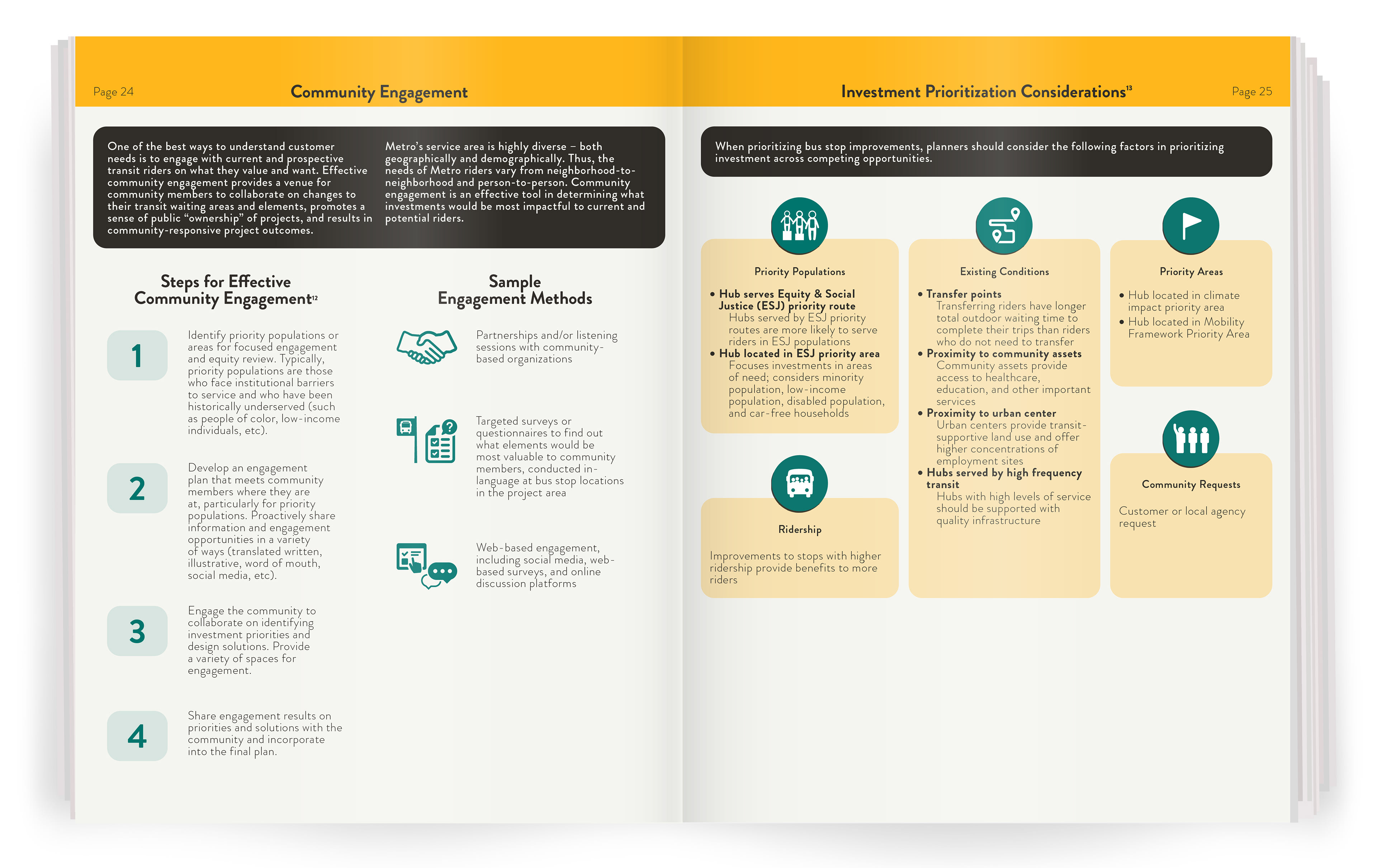
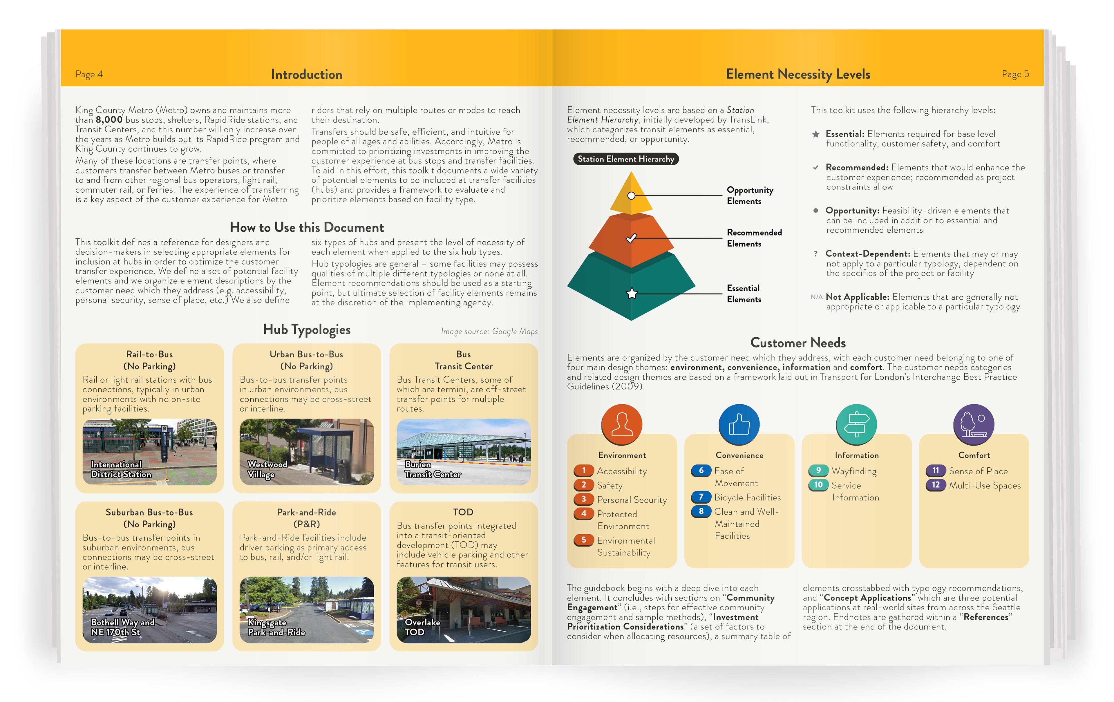
I structured the planning guidance into a clear, navigable system built around three pillars: Hub Typologies, Customer Needs, and Element Priority.
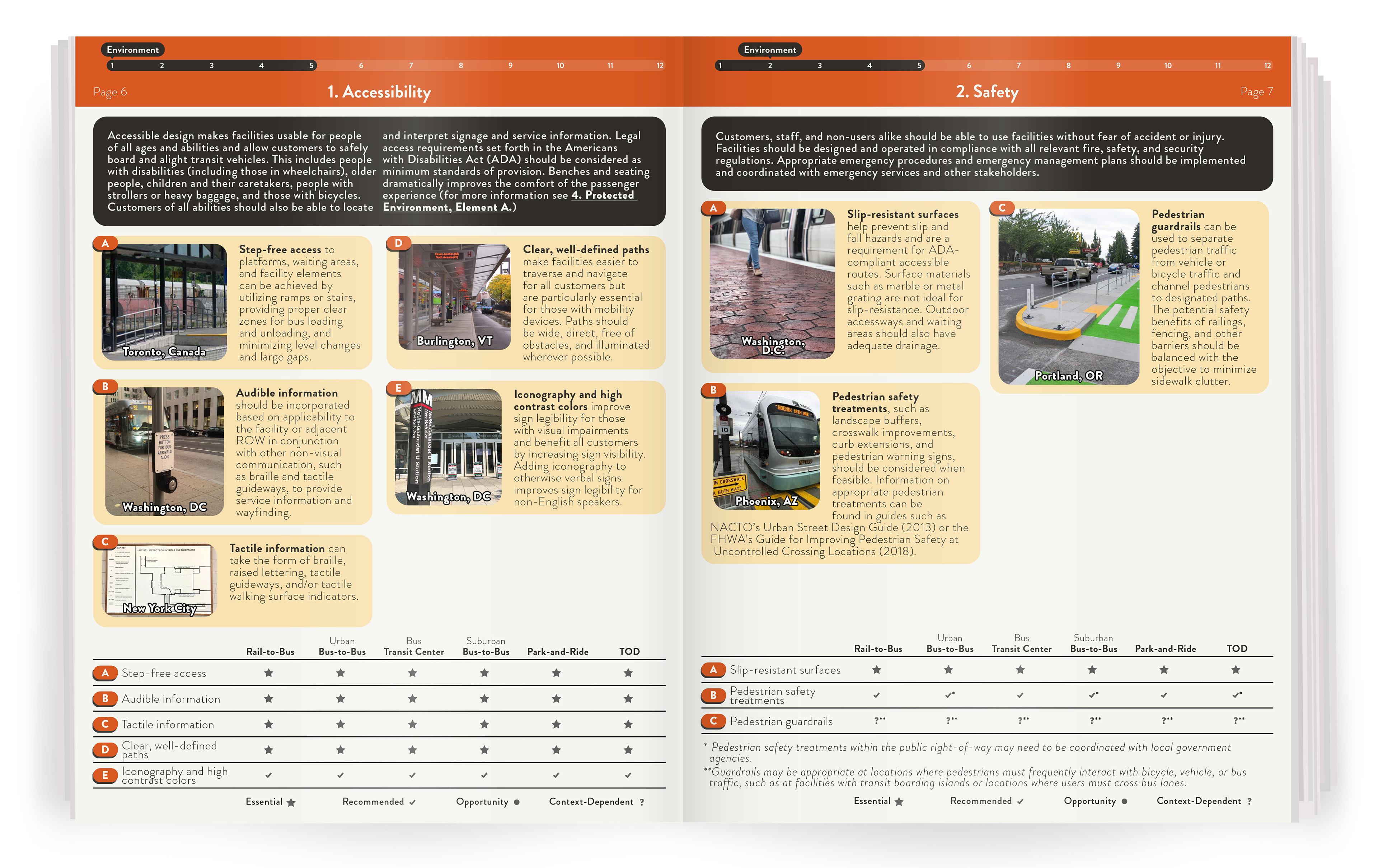
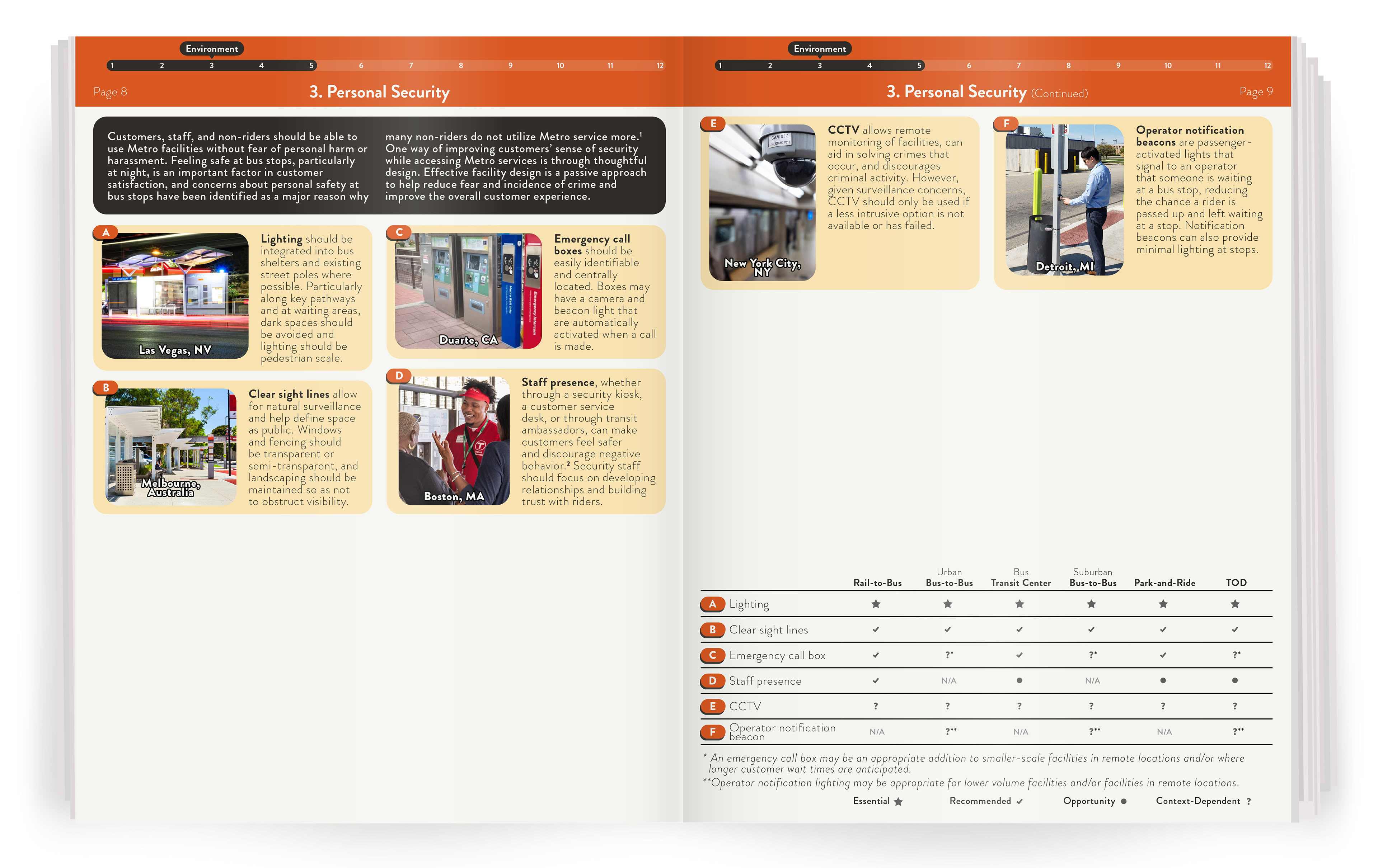
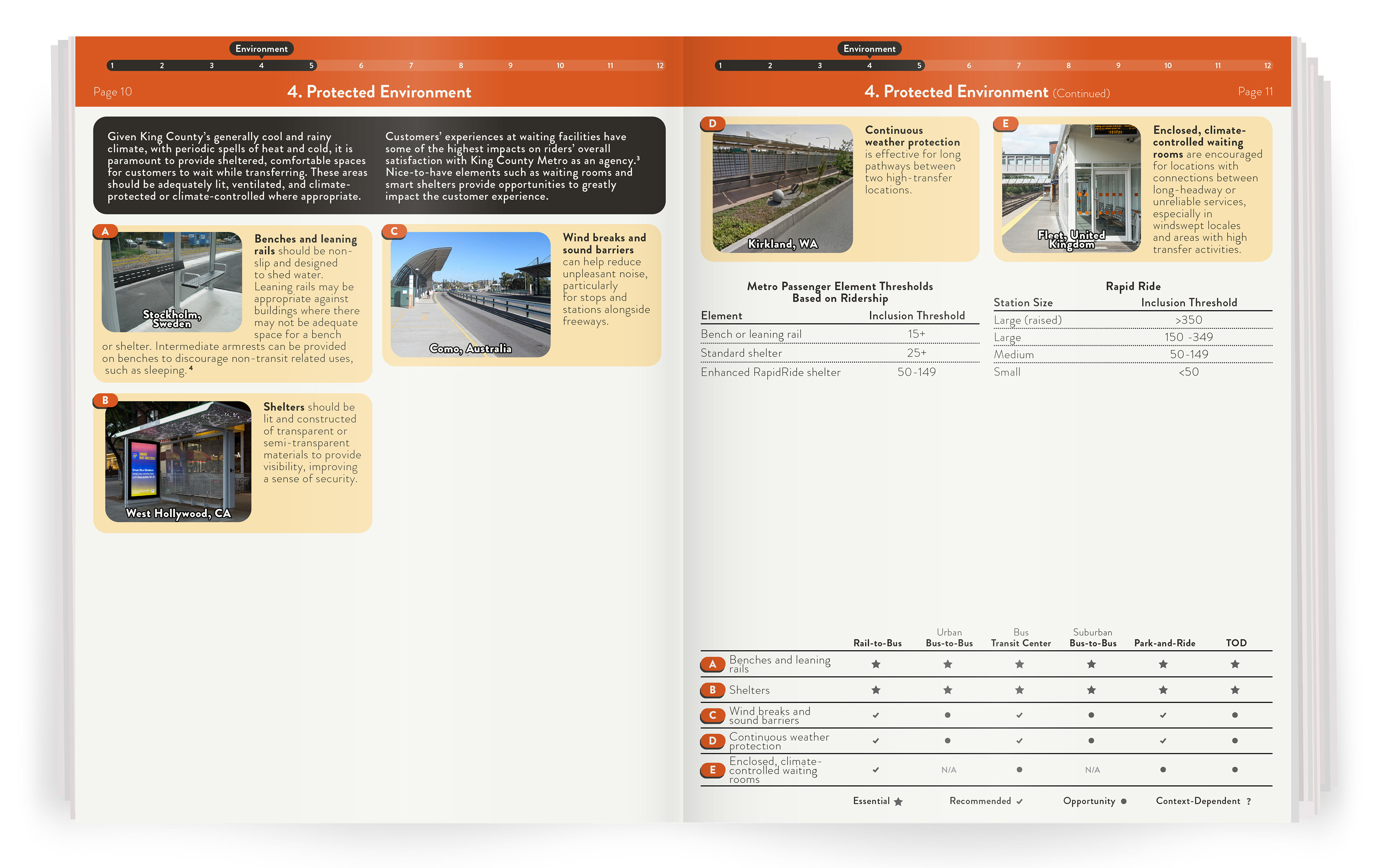
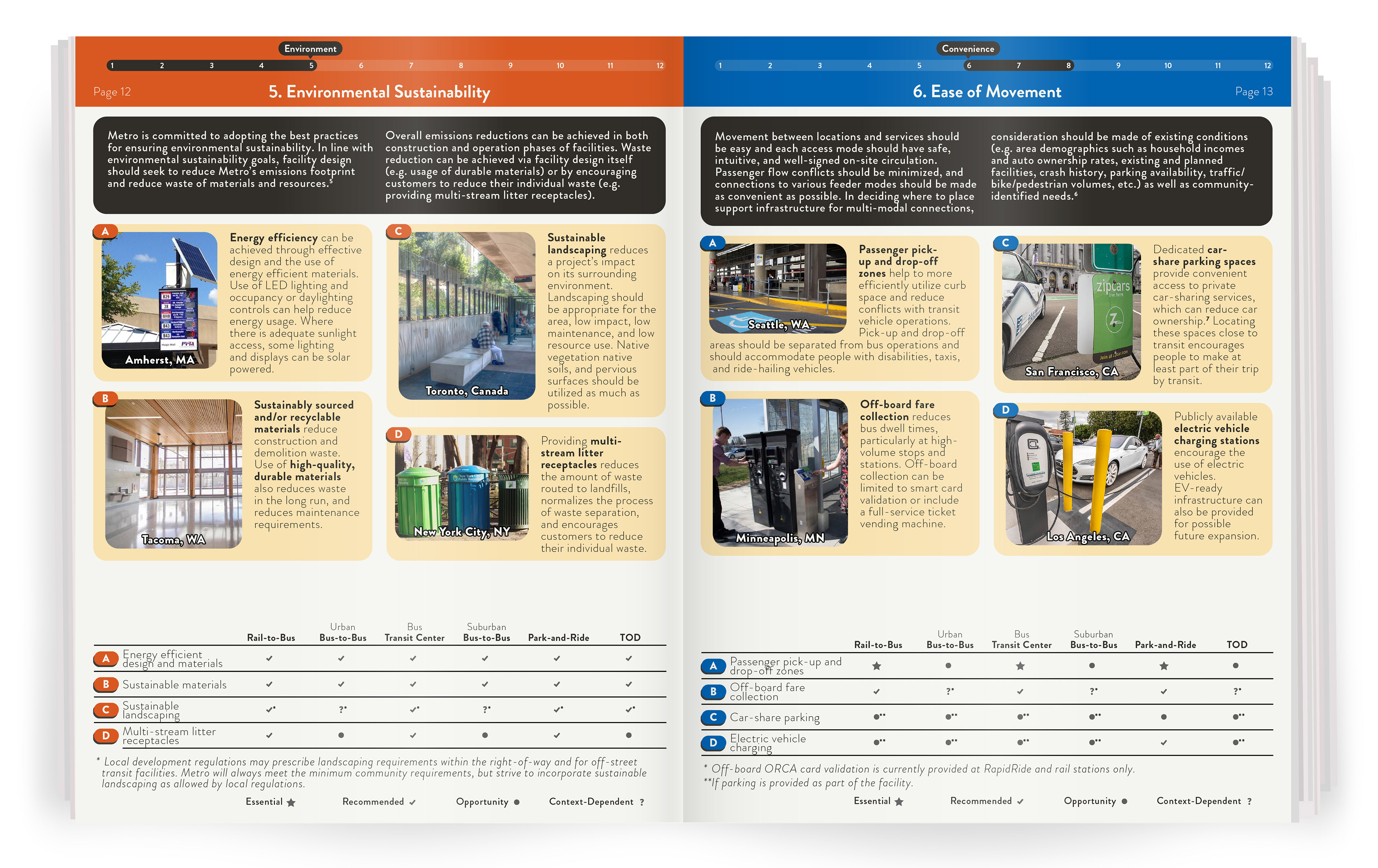
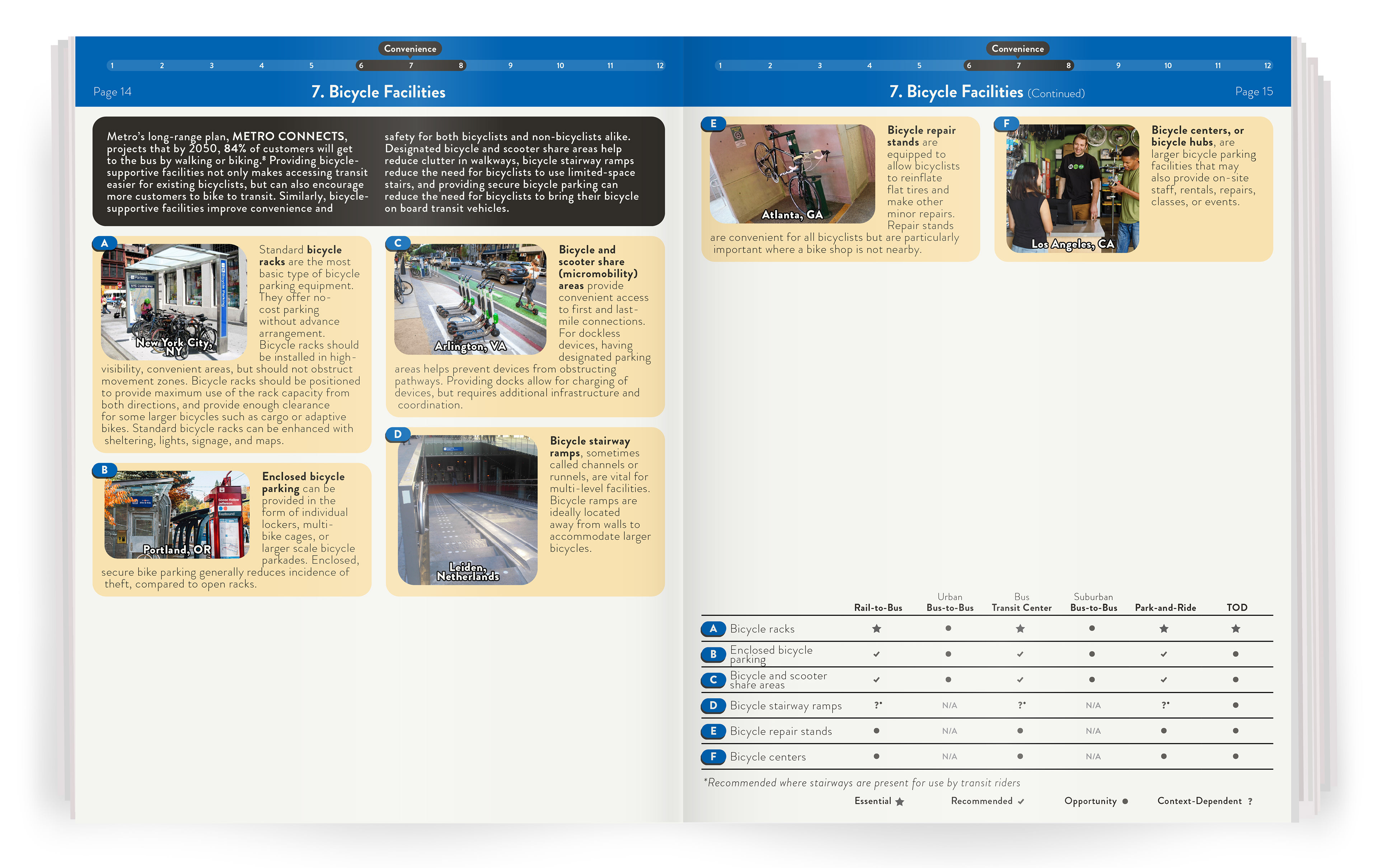
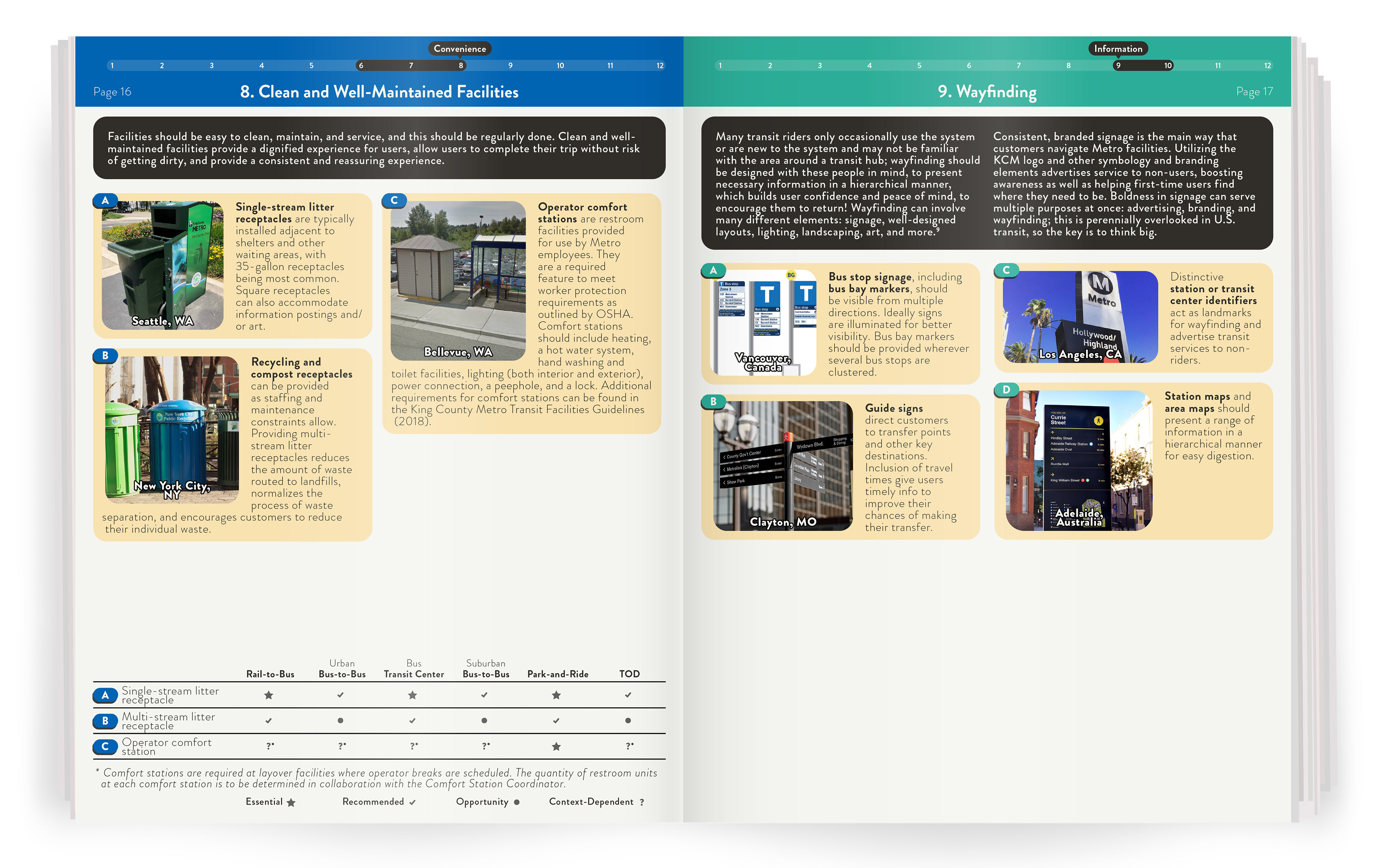
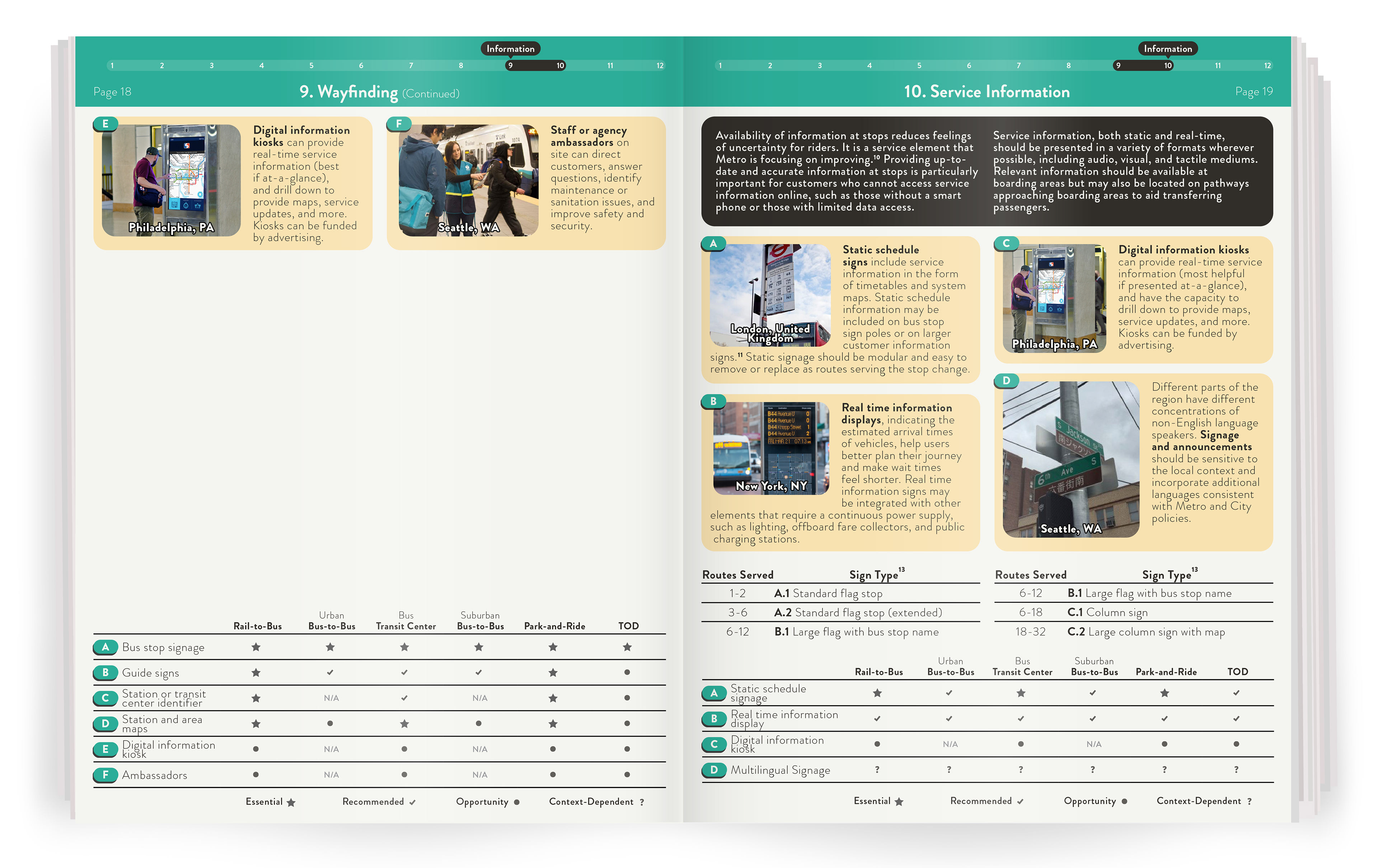
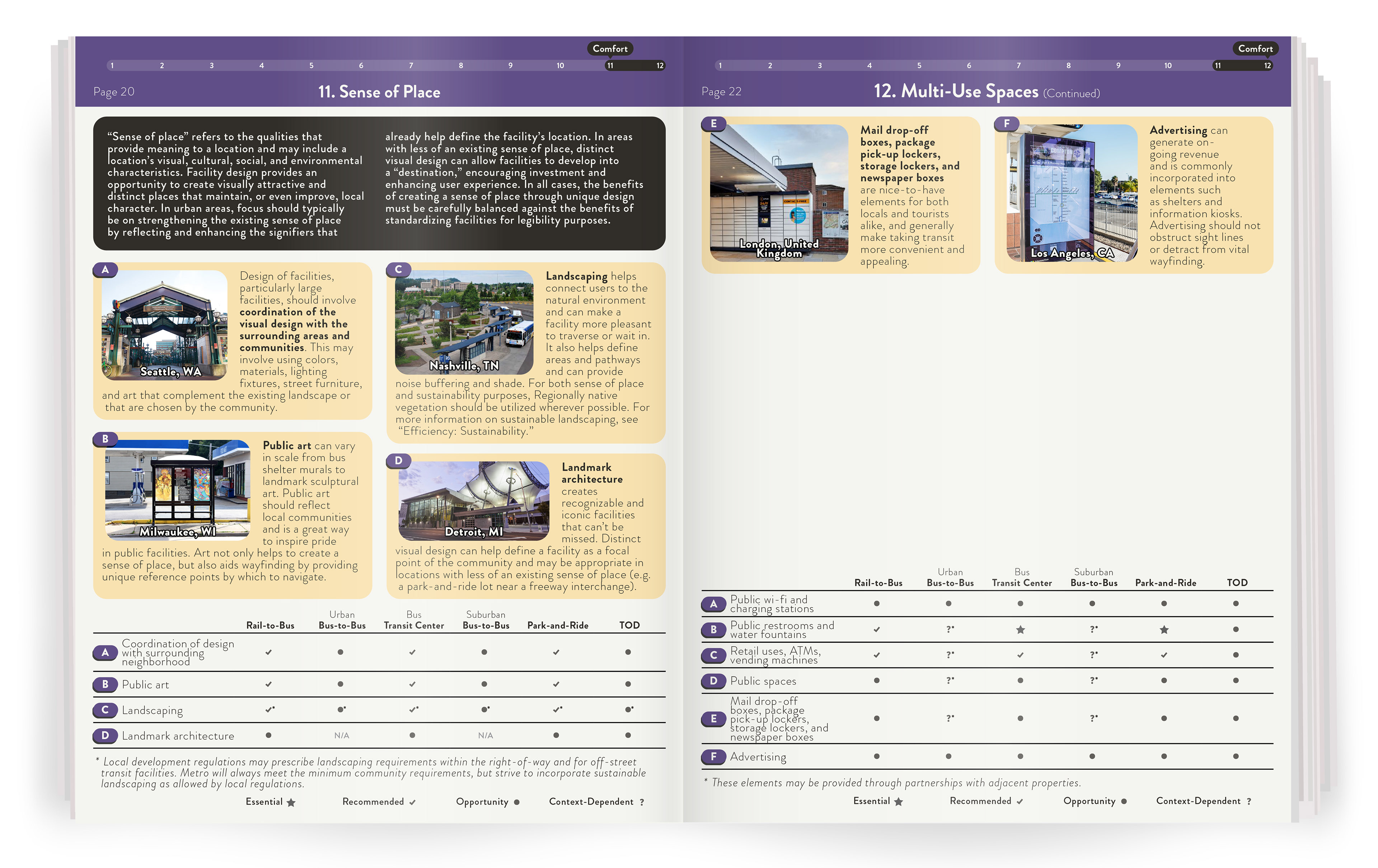
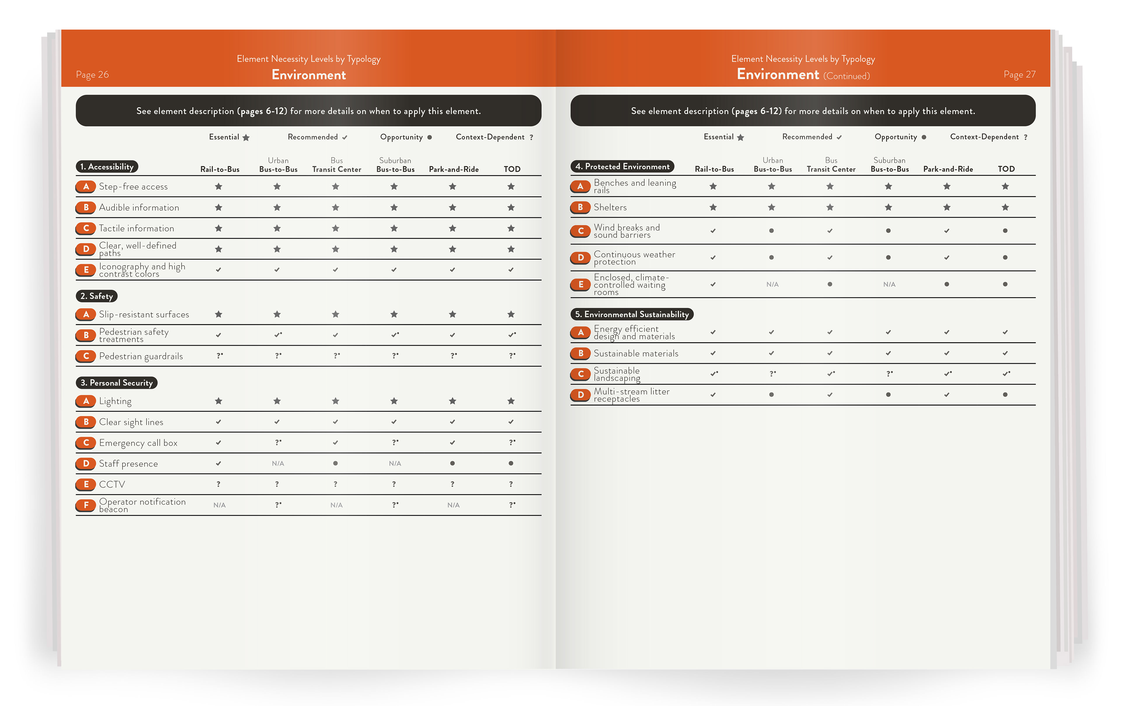
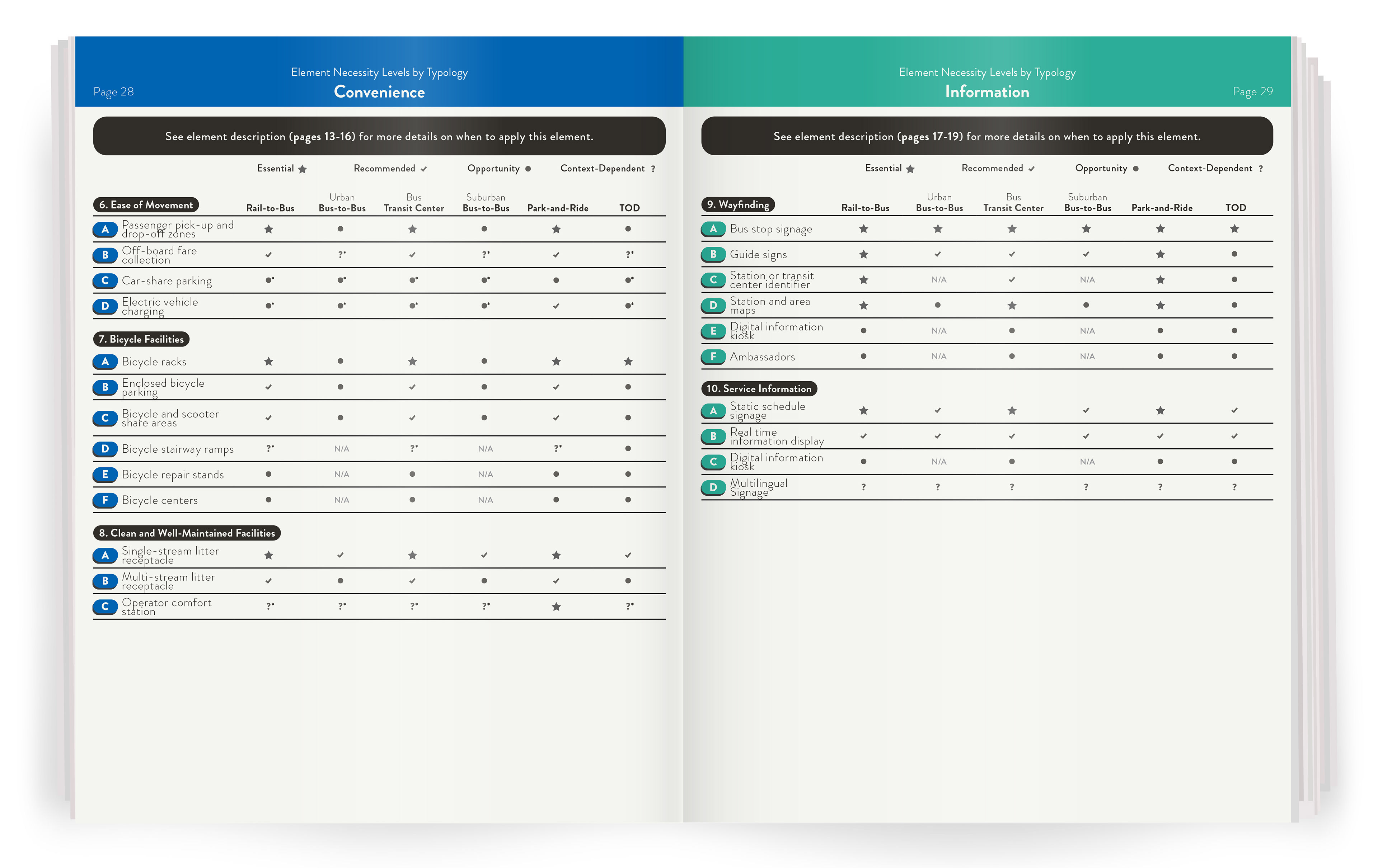
I defined hub typologies to establish context across different transit environments, then reframed technical considerations into four customer-centered categories: Environment, Convenience, Information, and Comfort. This shifts the focus from infrastructure to user experience.
A visual toolkit designed to help planners improve safety, accessibility, and usability at transit hubs through clear, structured guidance.
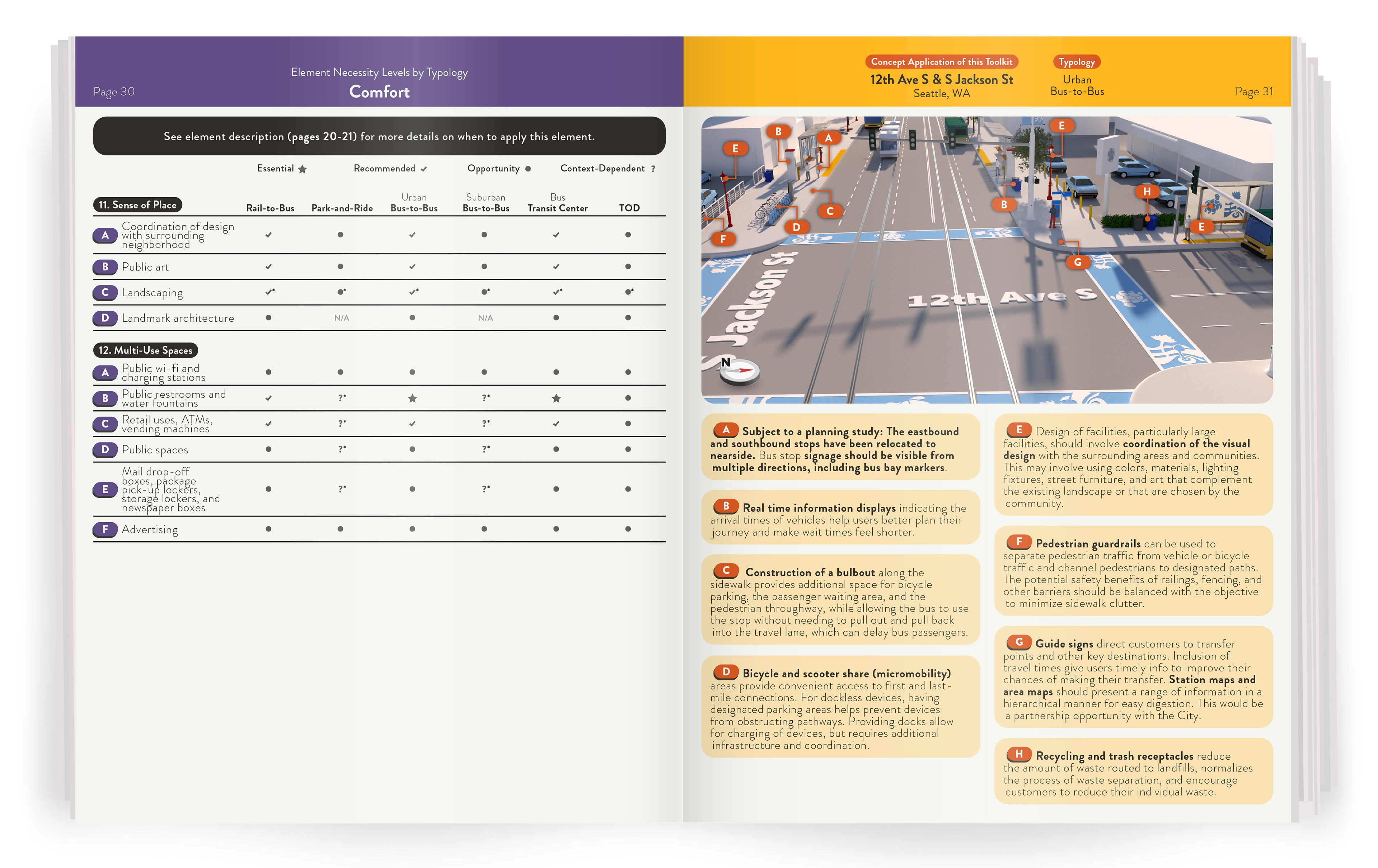
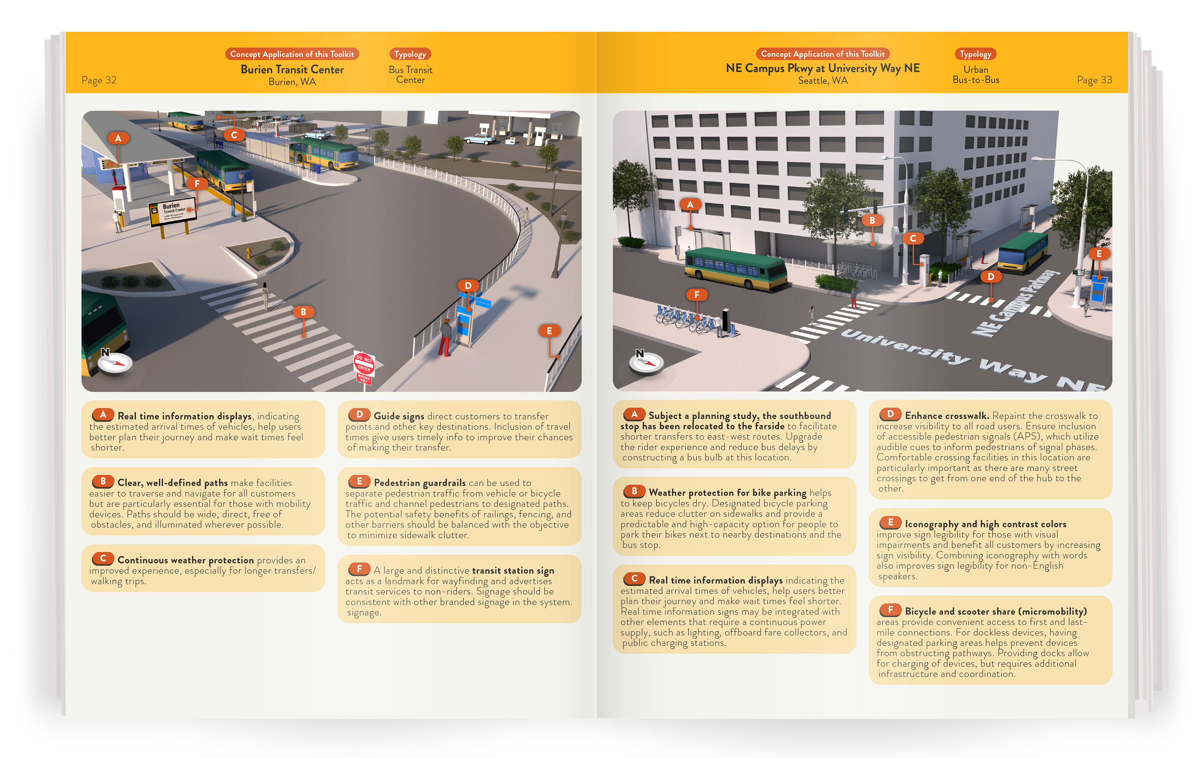
To validate the framework, I created 3D concept applications for some of the busiest transit hubs in the county. Each location demonstrates how elements such as signage, circulation, and amenities can be applied to improve safety, clarity, and the overall transfer experience.
Burien Transit Center: Improves circulation, wayfinding, and passenger safety through clearly defined paths, real-time information, and designated waiting areas.
University District (NE Campus Pkwy at University Way NE): Enhances safety and accessibility through improved crosswalk visibility, accessible signals, and integrated micromobility features.

Browse the full report below to see the complete framework and supporting details: