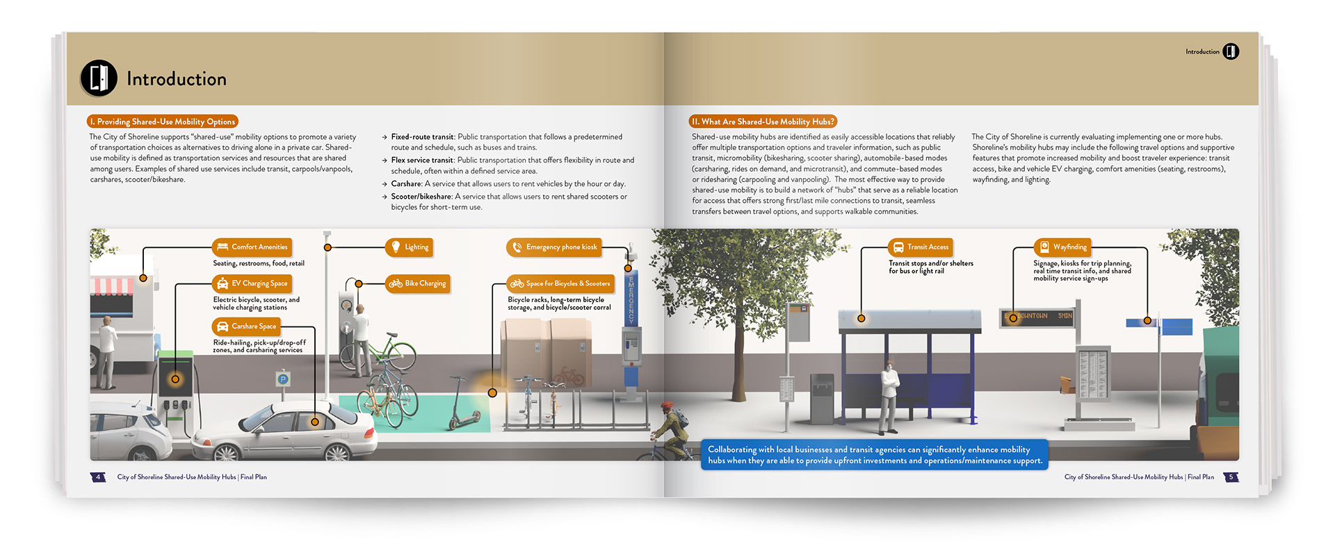
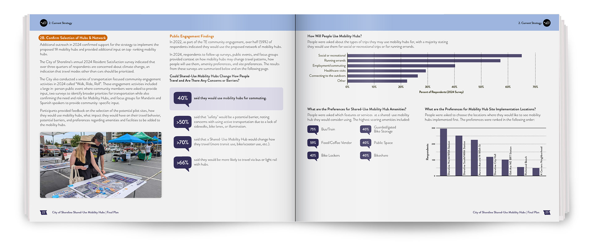
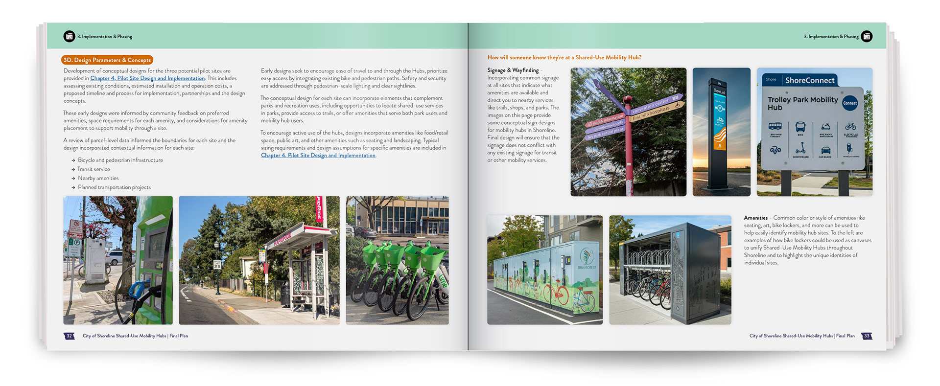
Shared-use mobility hubs bring together buses, rideshare, bicycles, and e-scooters into a single, coordinated location, enabling seamless travel without switching between disconnected stops.
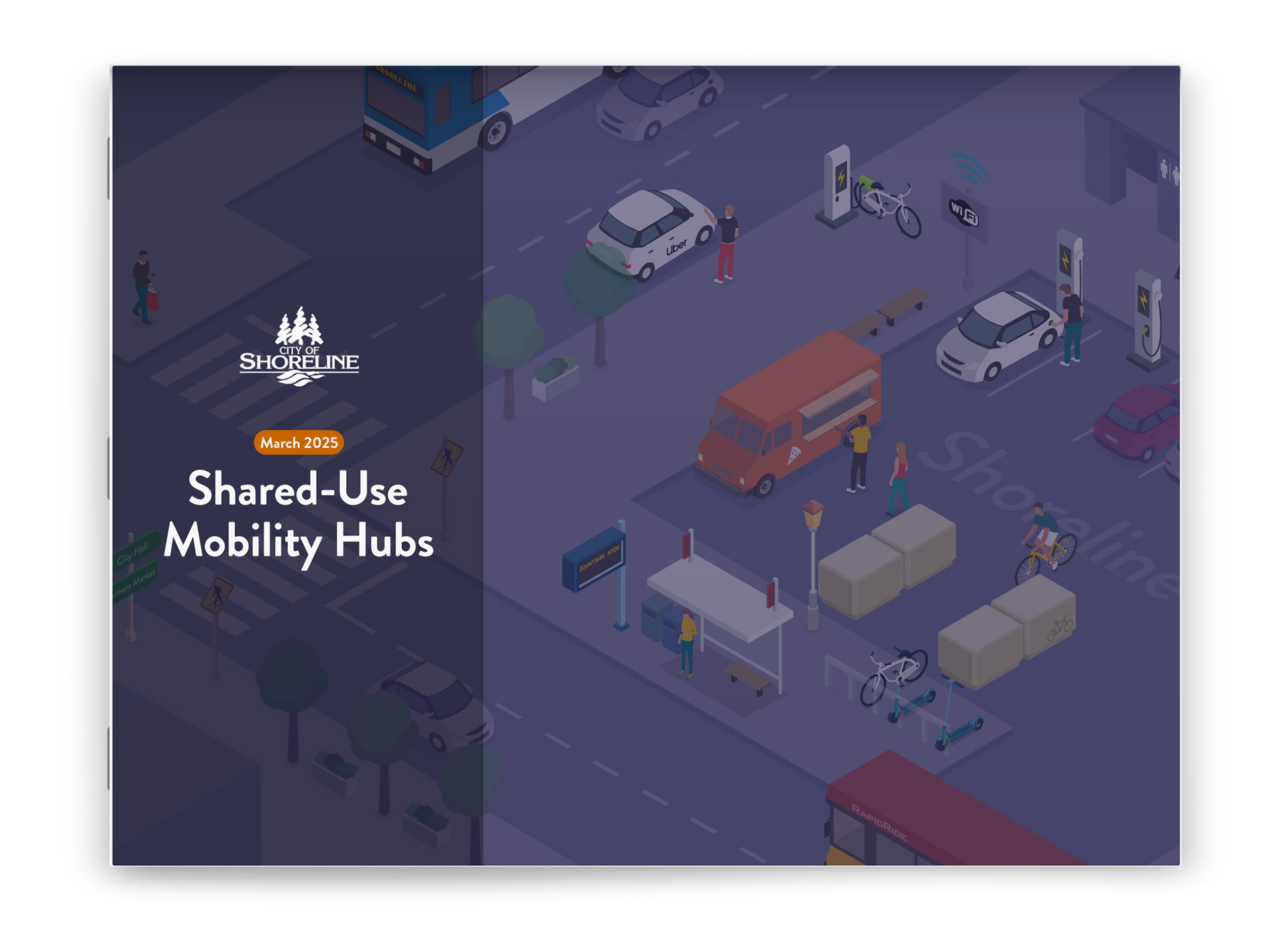
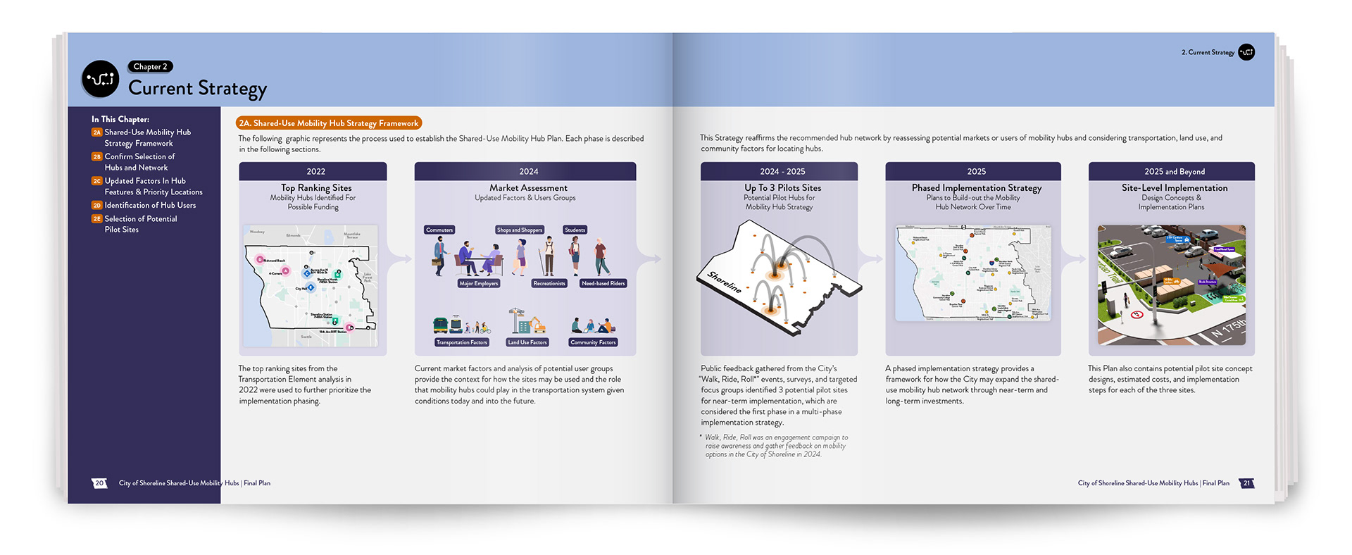
For the City of Shoreline, I designed a visual system that turns a policy-driven plan into clear, approachable guidance, helping people understand how shared-use mobility hubs function within the built environment. The challenge was to make a complex planning vision understandable and relevant to the community.
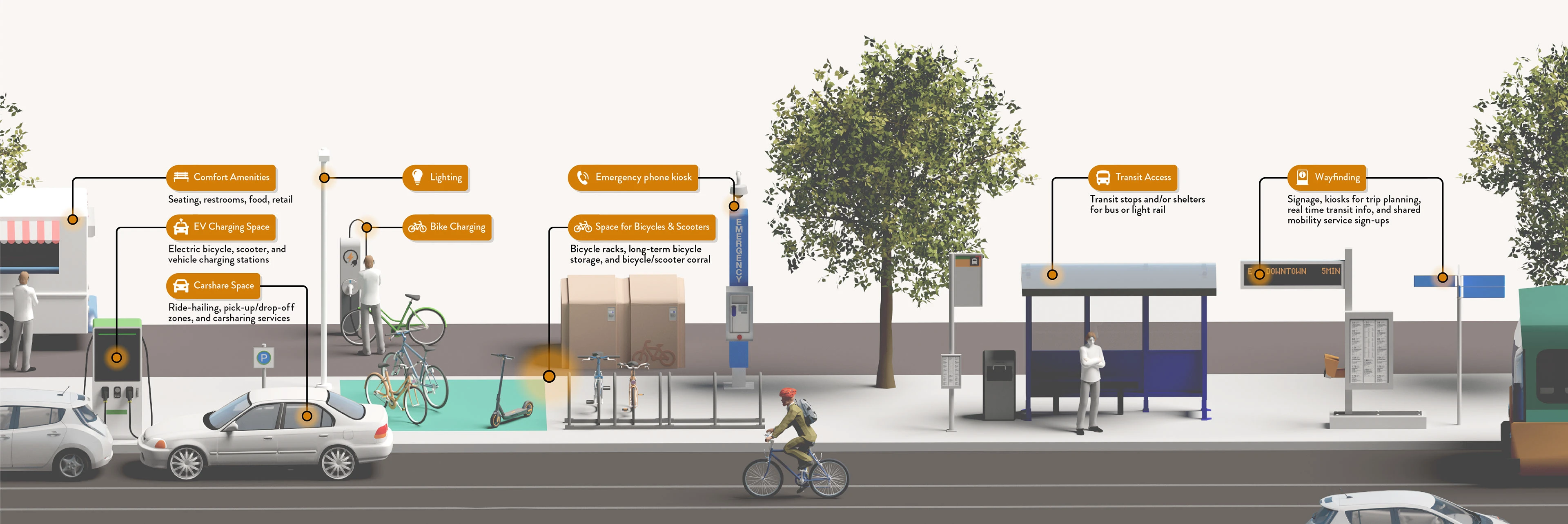
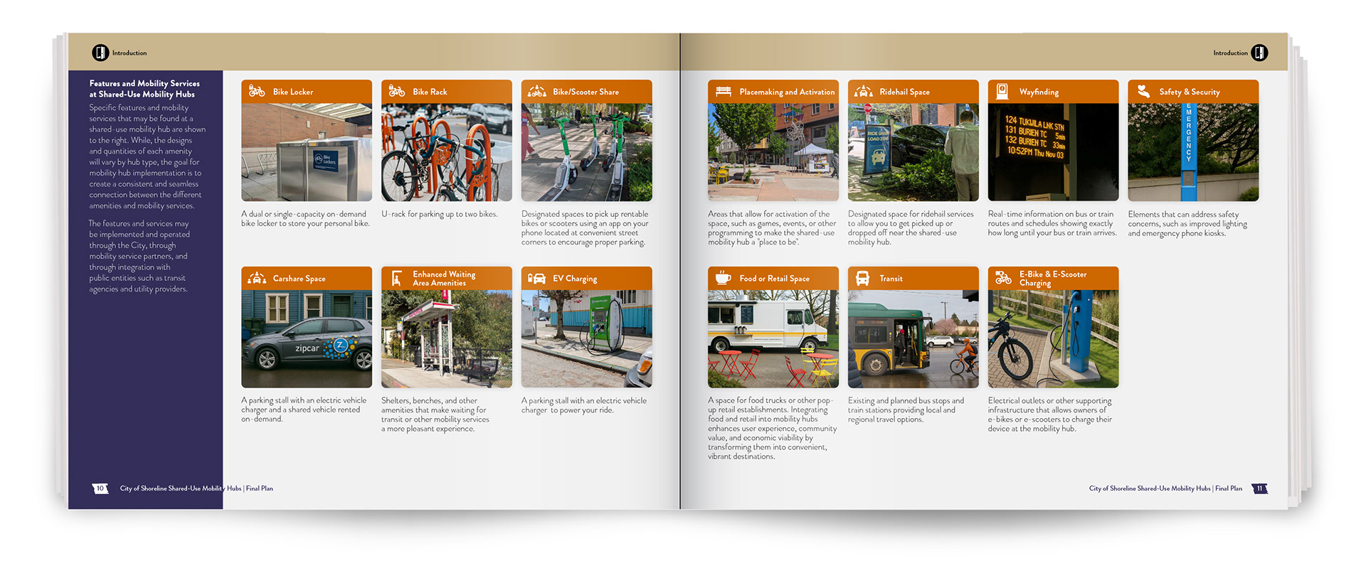
Illustration of a shared-use mobility hub showing how transit, micromobility (bikes & e-scooters), and rideshare vehicles are integrated with amenities to support seamless travel.
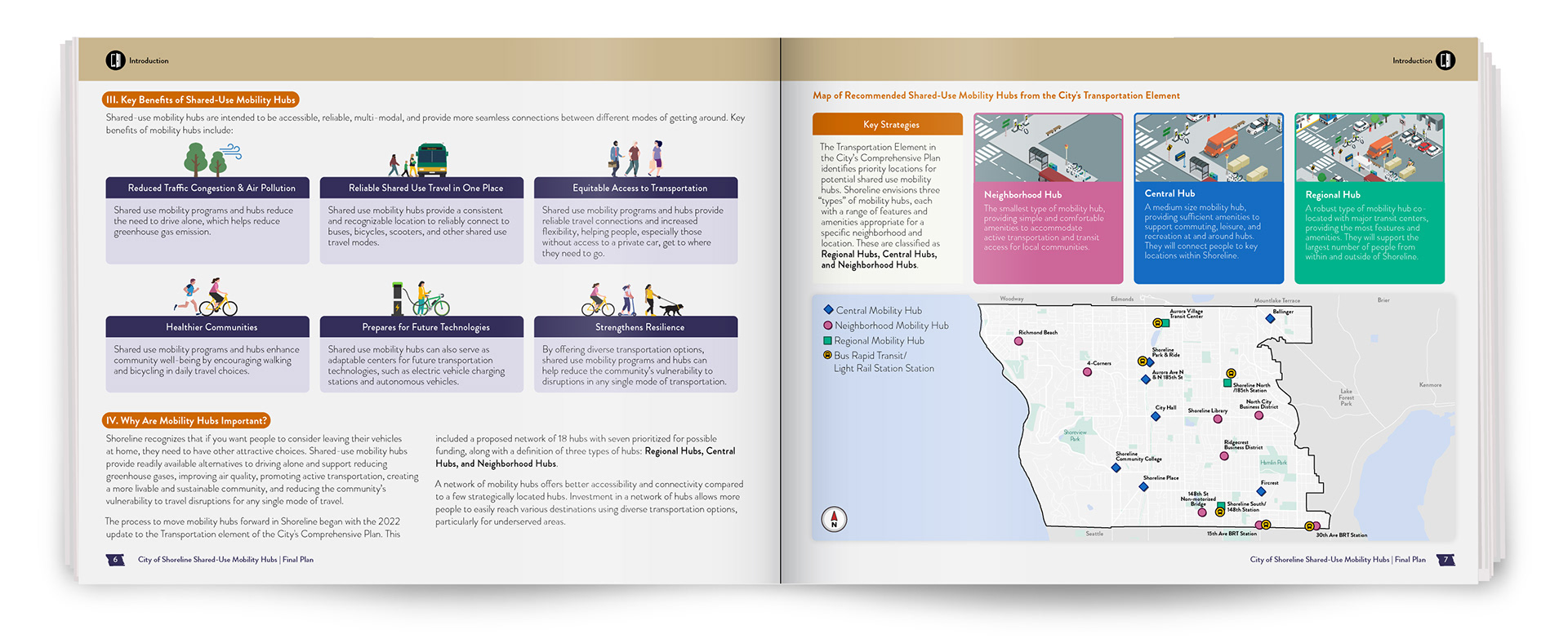
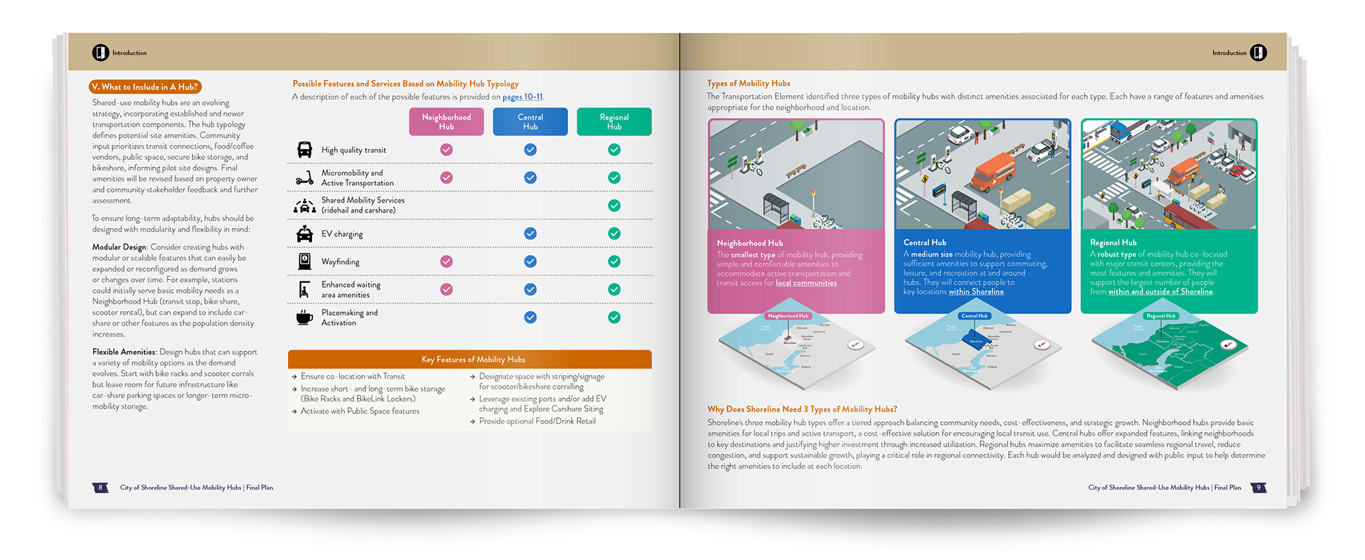
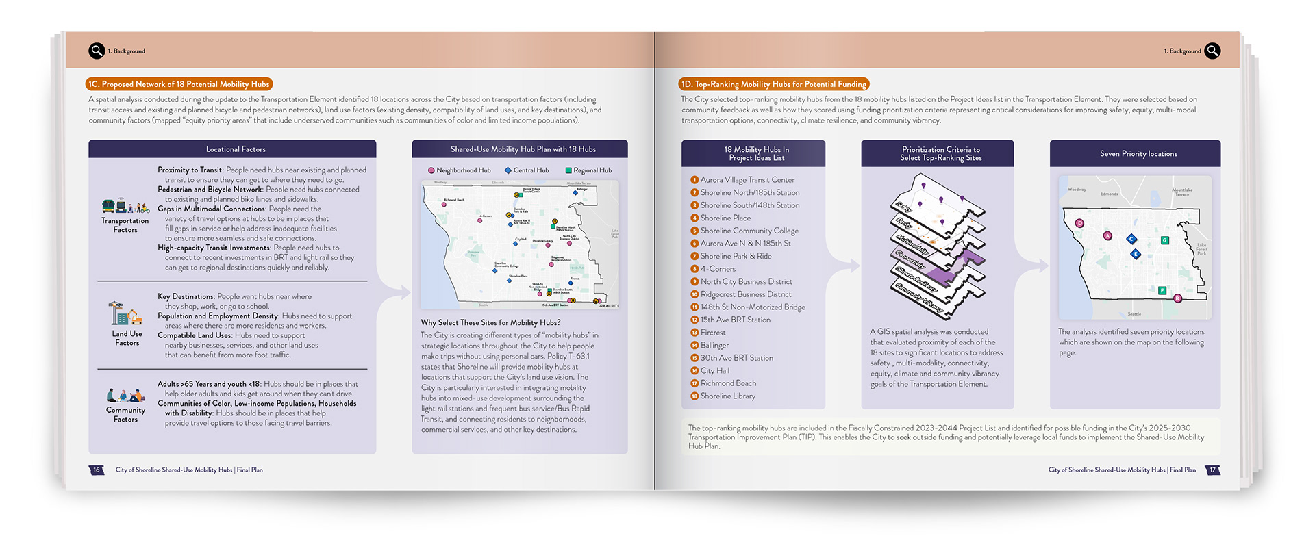
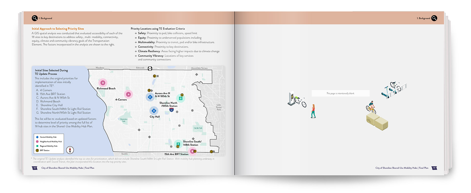
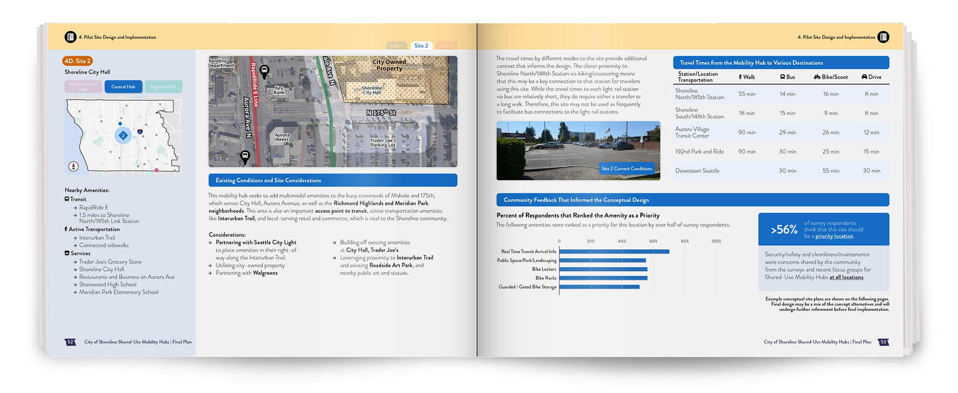
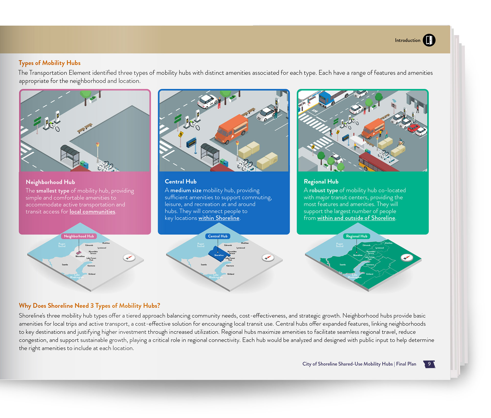
A key part of the plan was visually representing three types of shared-use mobility hubs: Neighborhood, Central, and Regional. Each hub type is tailored to different community needs, from local access to regional connectivity, helping planners apply the right level of investment and infrastructure. I used color-coded text, illustrations, and maps to show how each type is tailored to different parts of the community:
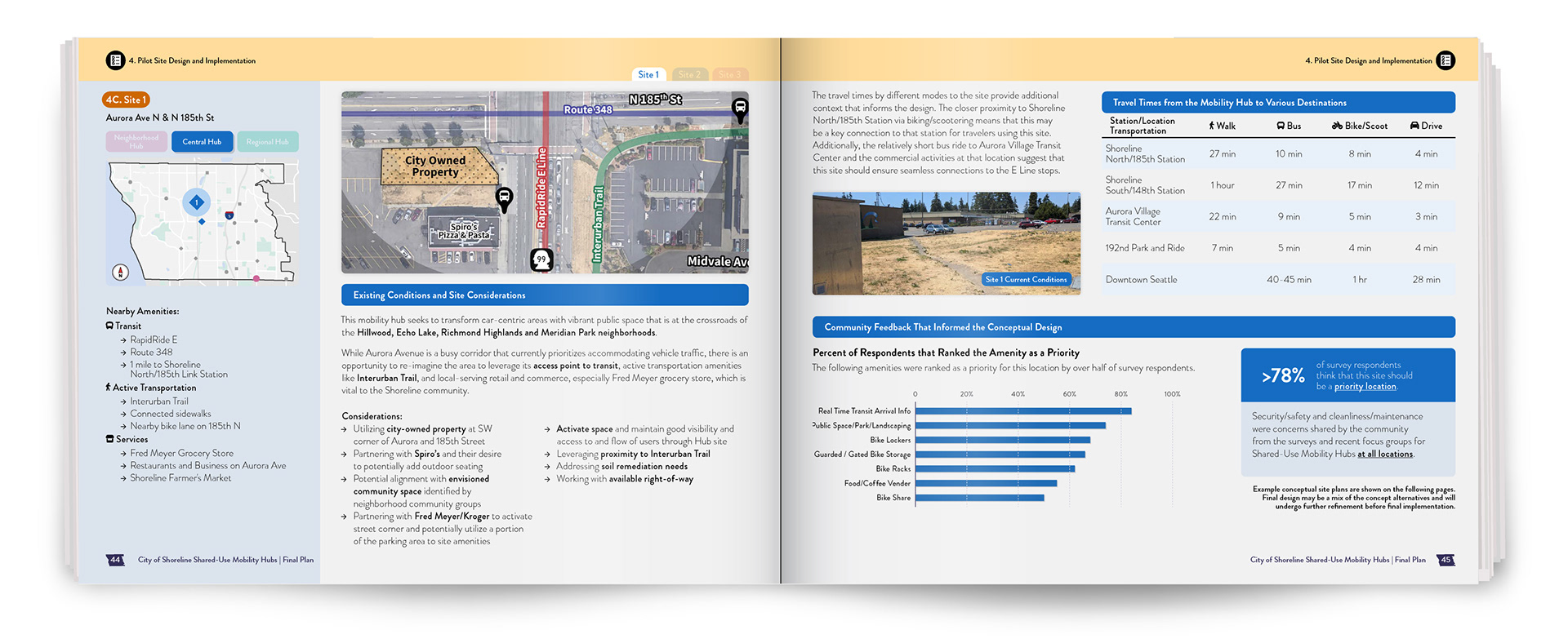
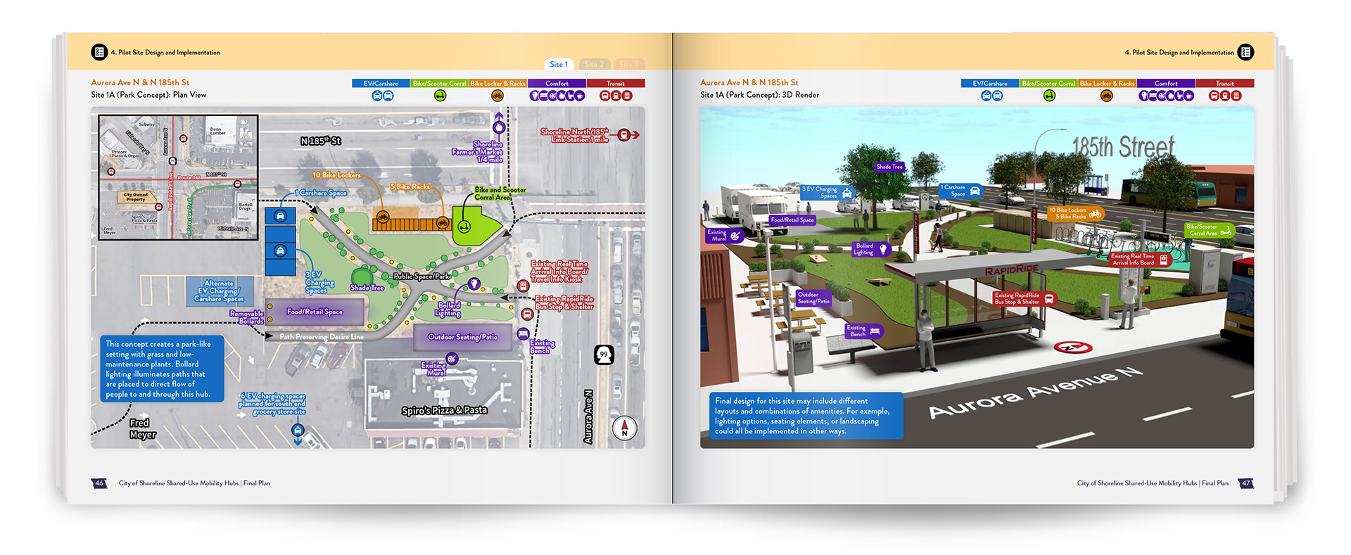
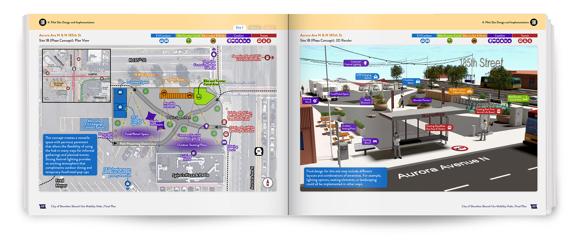
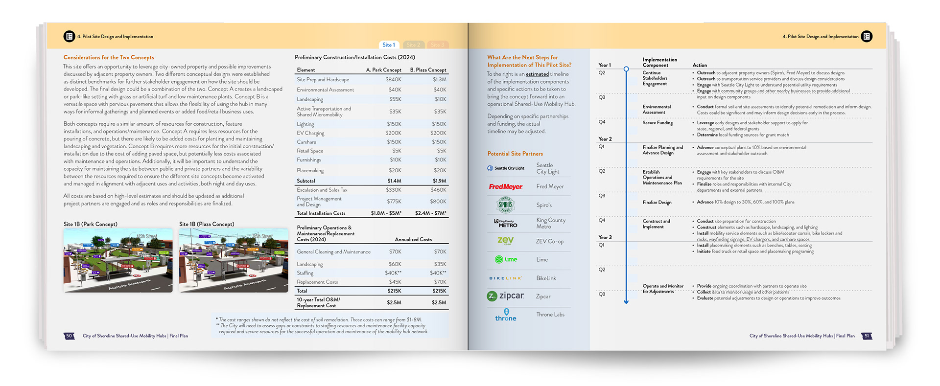
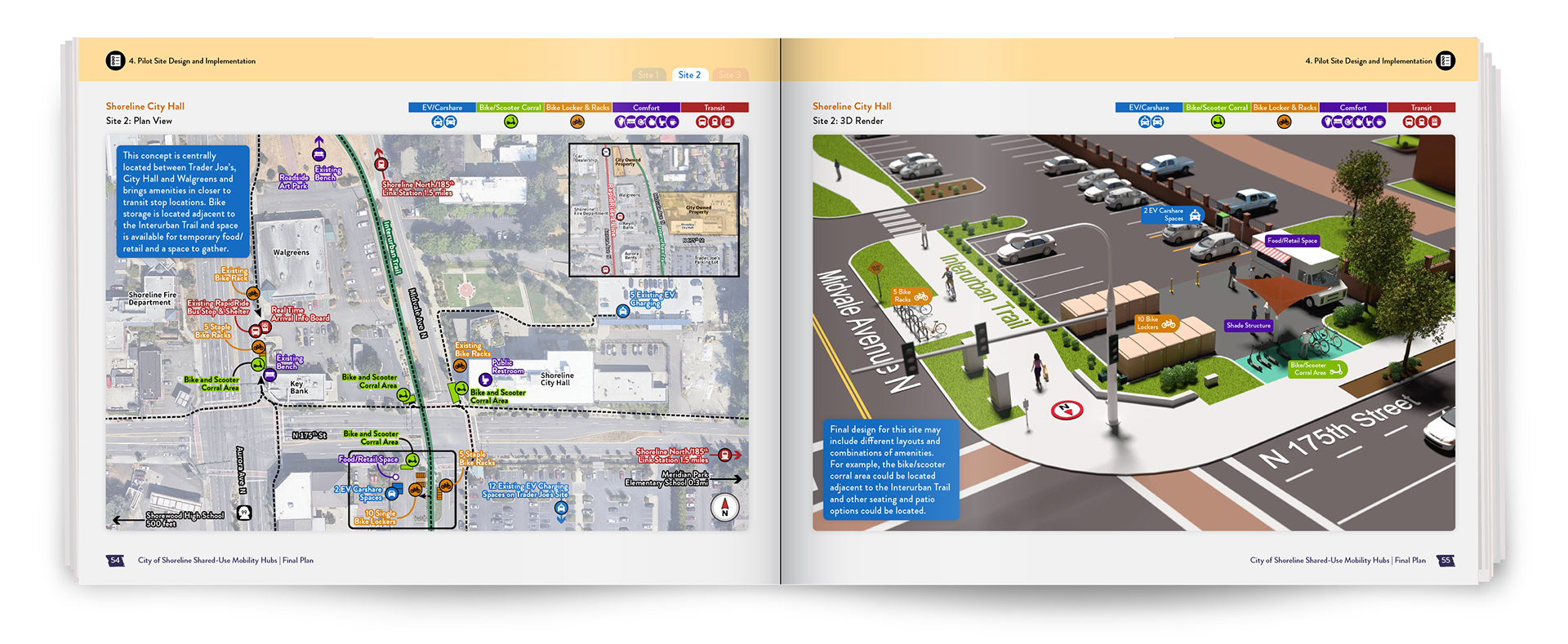
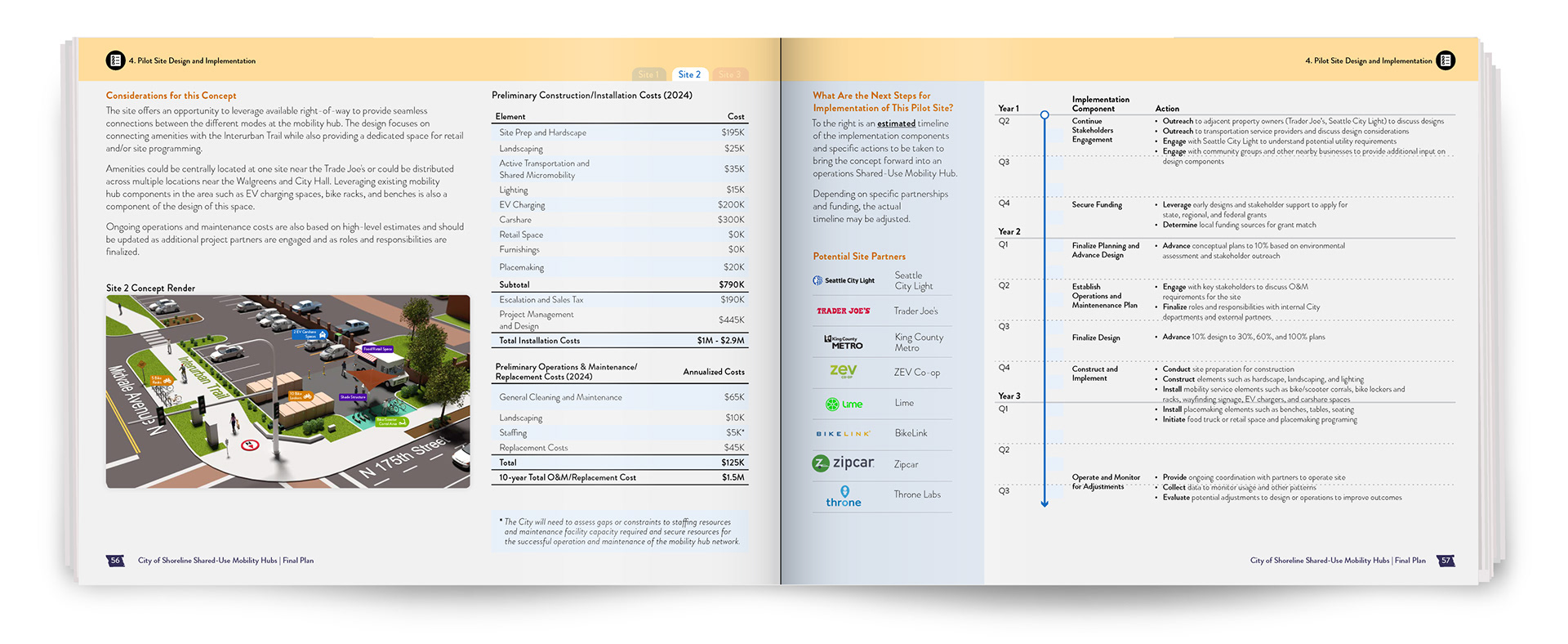
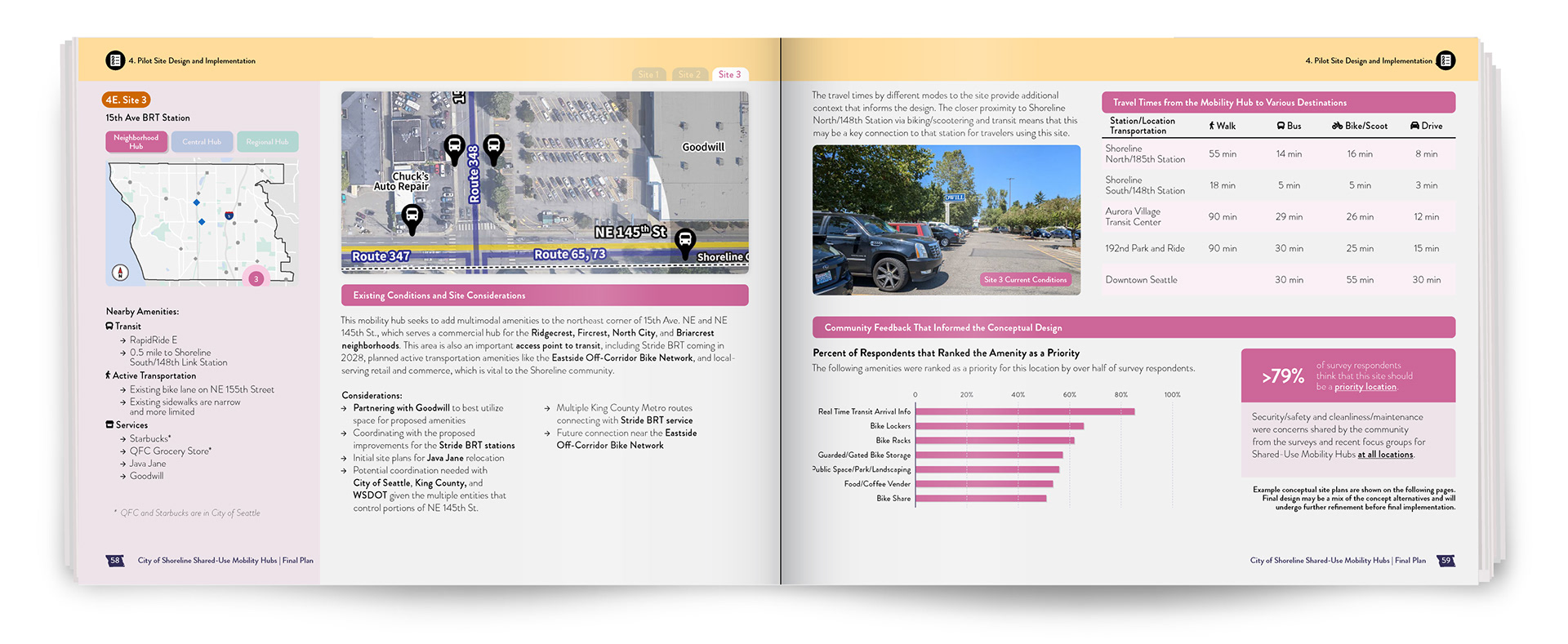
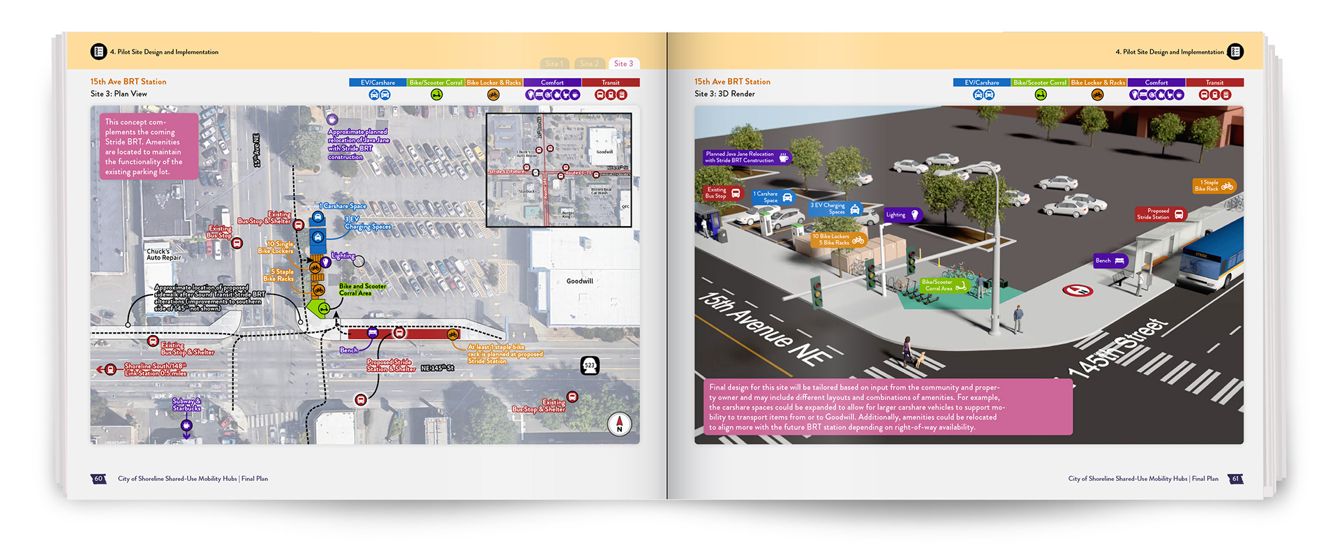
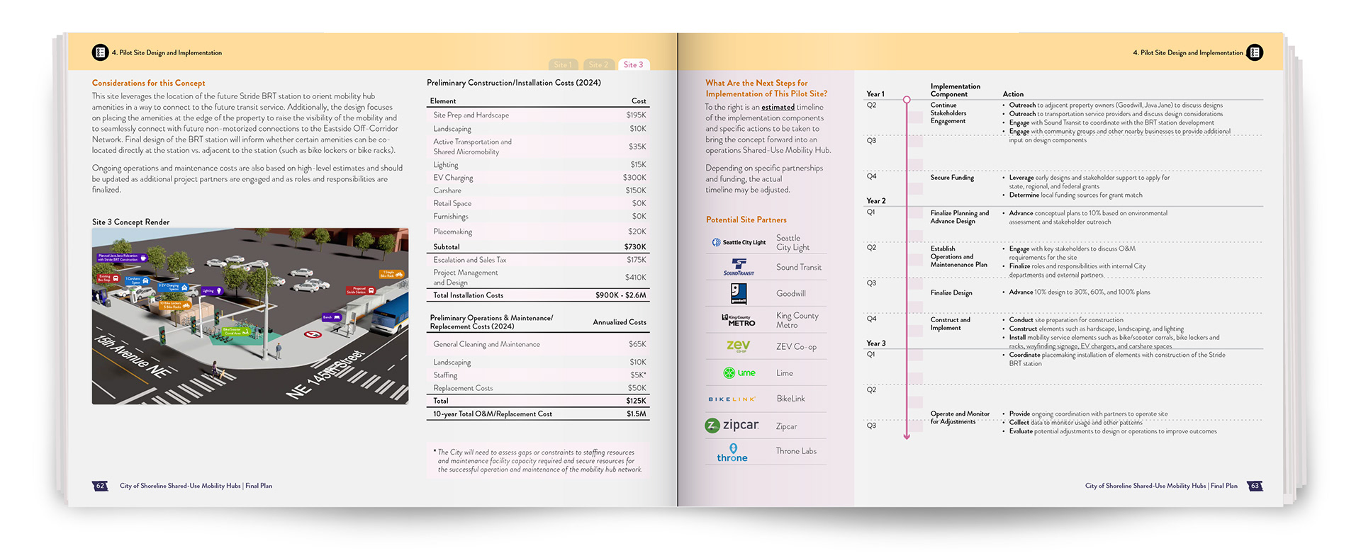
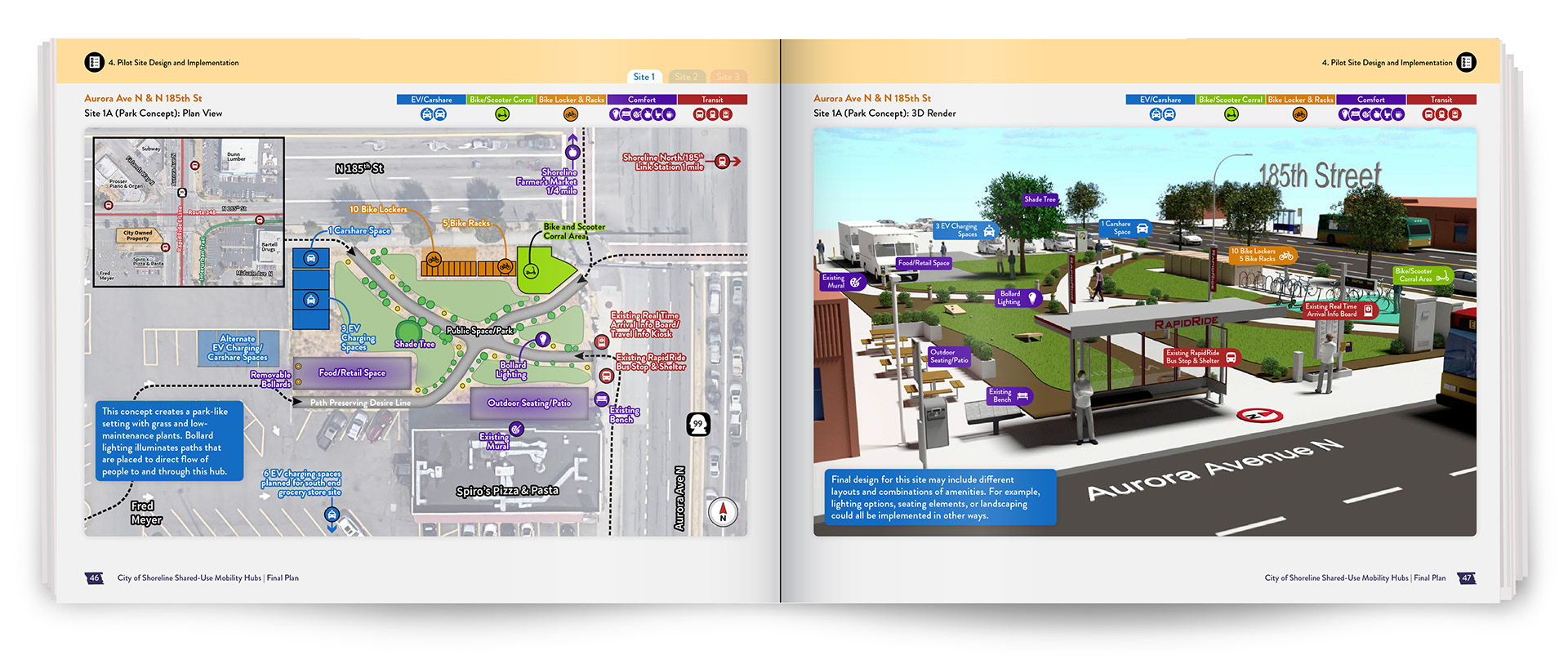
Three sites across the city were selected to demonstrate how shared-use mobility hubs can be applied in real-world contexts. The example below shows how 2D site planning and 3D visualization work together to illustrate circulation, amenities, and the overall user experience at a specific location:
Corridor-scale hub showing how transit, micromobility, and pedestrian infrastructure are organized along a high-traffic arterial.
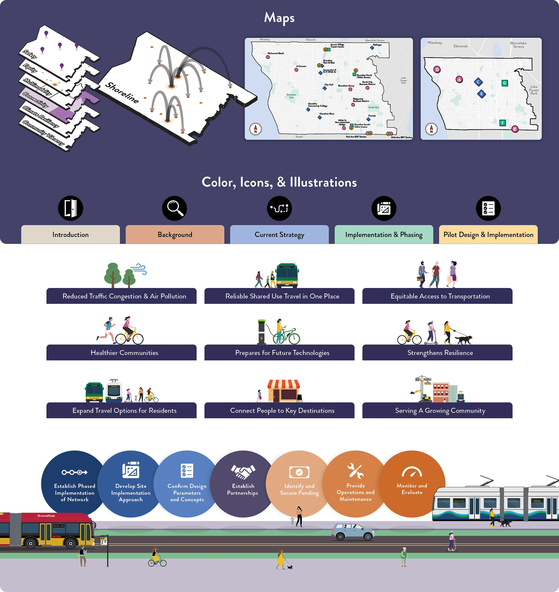
To support clarity and consistency across the plan, I developed a visual system that organizes maps, iconography, typography, color, and illustration into a cohesive framework. This system ensures that complex information is communicated consistently, making the overall report easier to understand.
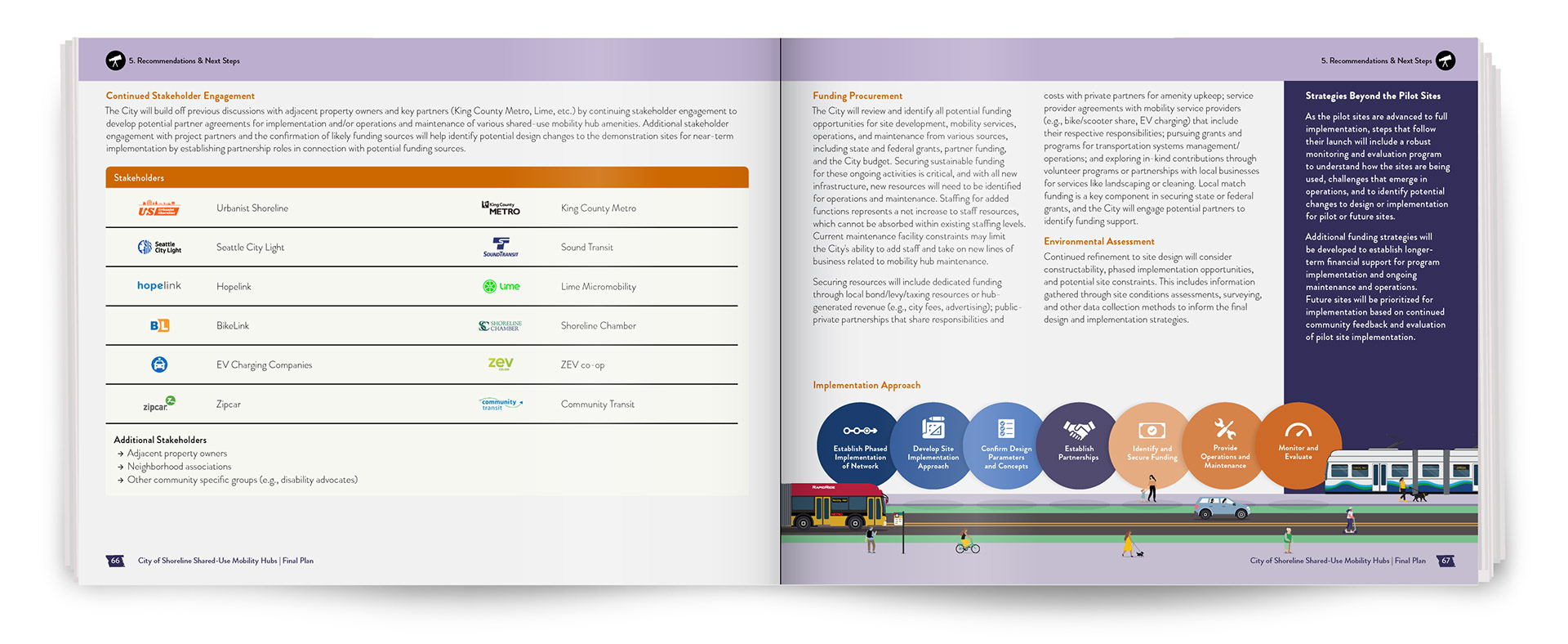
For an in depth look at the entire Shared-Use Mobility Hubs Plan, check out the pages below: